
- Spectacular 9.5km trail which can be surprisingly challenging in places. Waterproof footwear and decent level of fitness required.
- Park and start on Rue Aly Duhr / Rue de la Résistance. If full, try the nearby cemetery parking lot.
- Nearest bus stop (300m): Ahn, Op der Musel.
Decisions, decisions from the starting point: Clockwise or anti-clockwise?
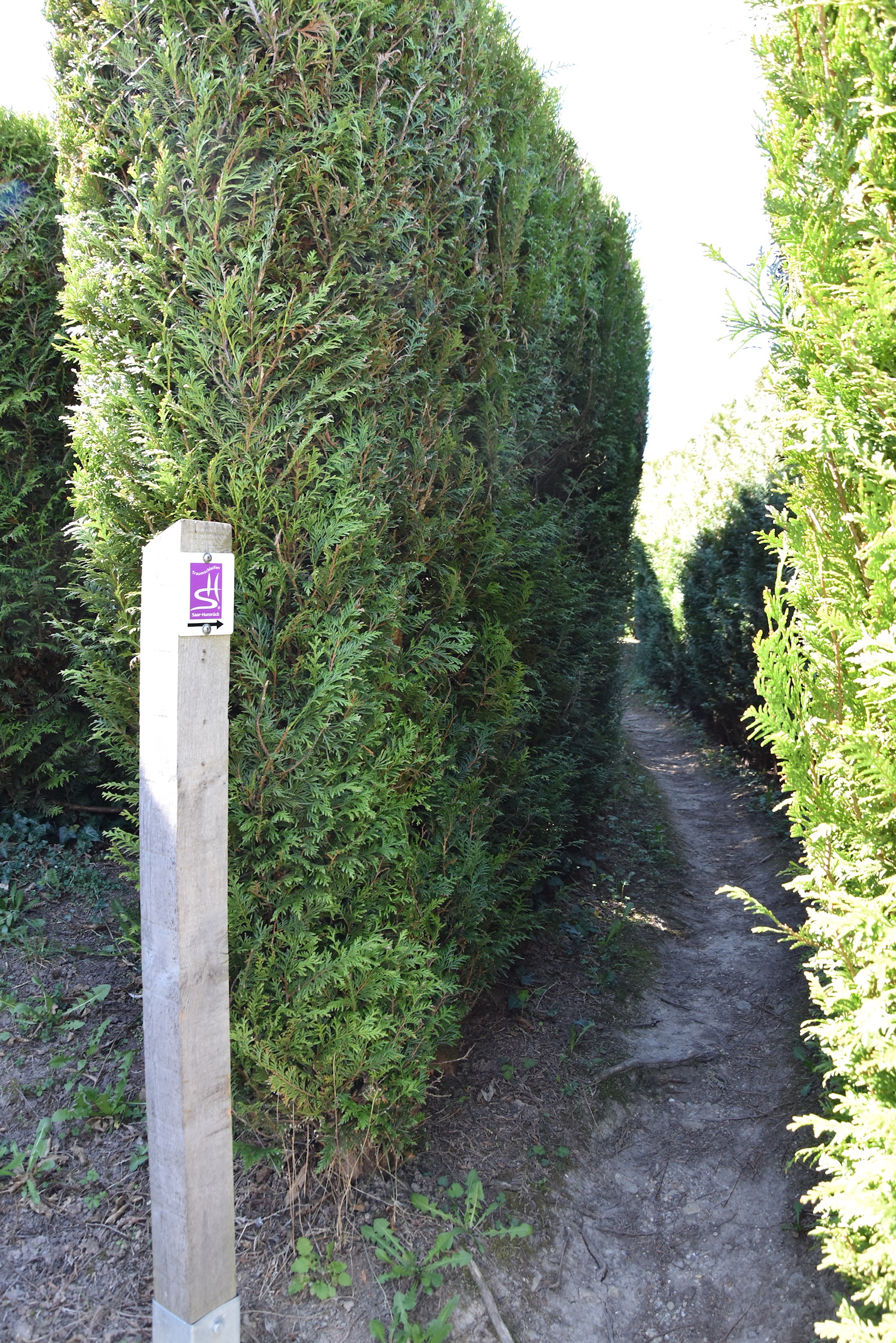
Anti-clockwise (let’s call it the “vineyard route”) has the advantage of getting the tough climbs out of the way right at the start of the hike, with the reward of the spectacular Moselle views that come with it. Clockwise (the “forest route”) has a lumpier and less scenic beginning, but does have the unique feature (in Luxembourg at least) of starting the hike in a labyrinth. Find your way out, and off you go!

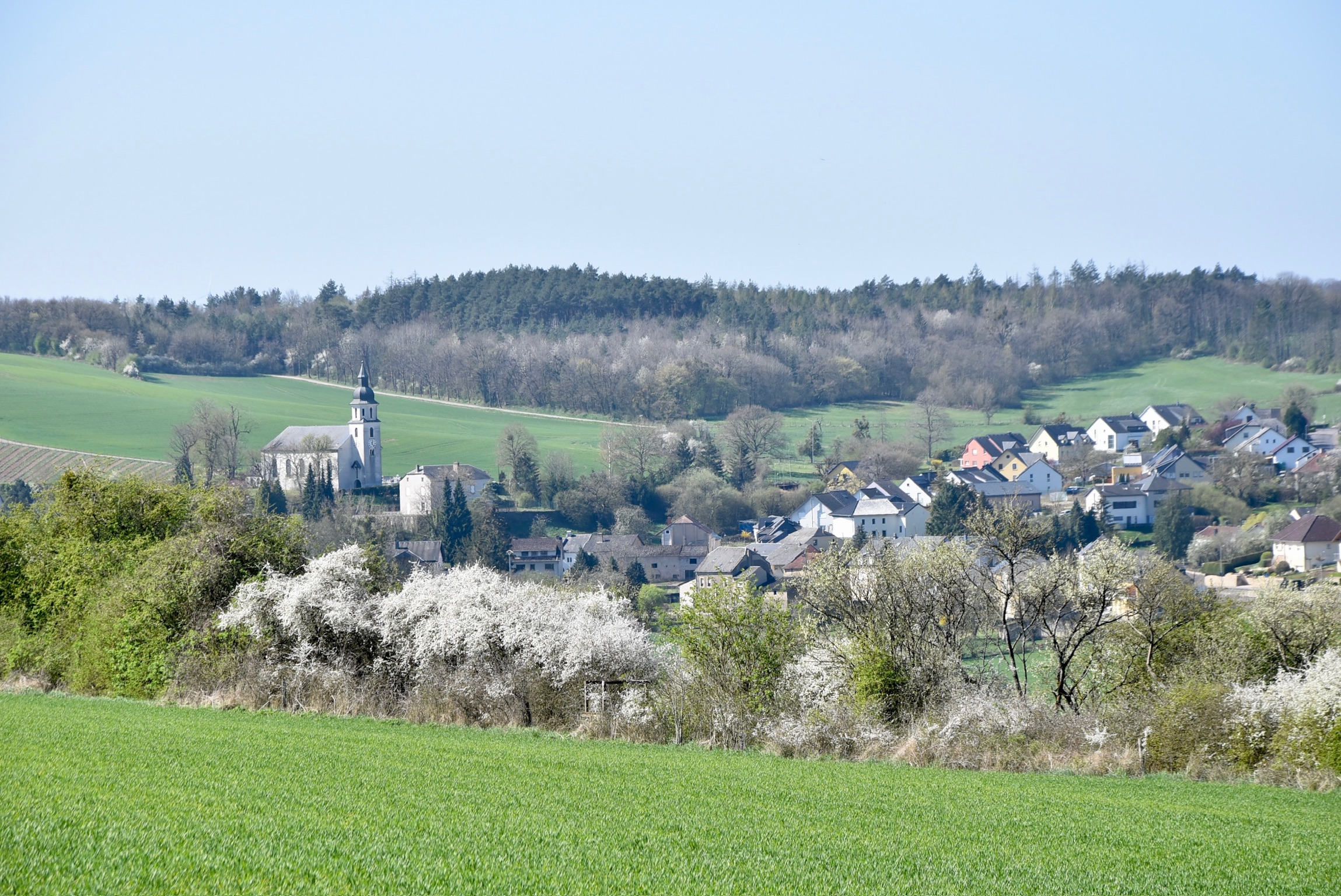
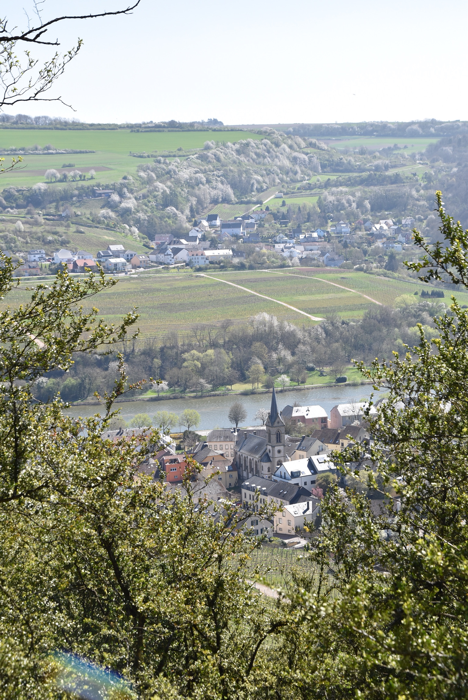
We chose anti-clockwise, Olympics 400m-style, and those promised Moselle views certainly didn’t disappoint. The vines may still have been bare on this fine early spring morning, but the village of Ahn looked positively fairytale-esque in its blanket of fresh green shoots and snow-white plum bloom.

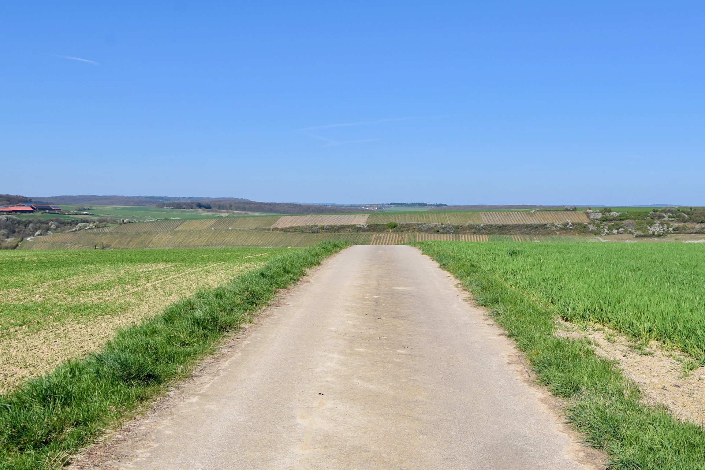
After a couple of kilometers of confident, self-assured climbing, the trail seems to become uncertain of itself. It briefly dips sharply into forest and up even more sharply on vine-terrace steps, before deciding that it enjoys the heights of the plateau best of all, and sticking there. This flatter segment of the hike is by far the least interesting, but you probably won’t mind the chance for a breather, particularly since it allows the opportunity to savour the views over the Moselle valley and across the plateau.
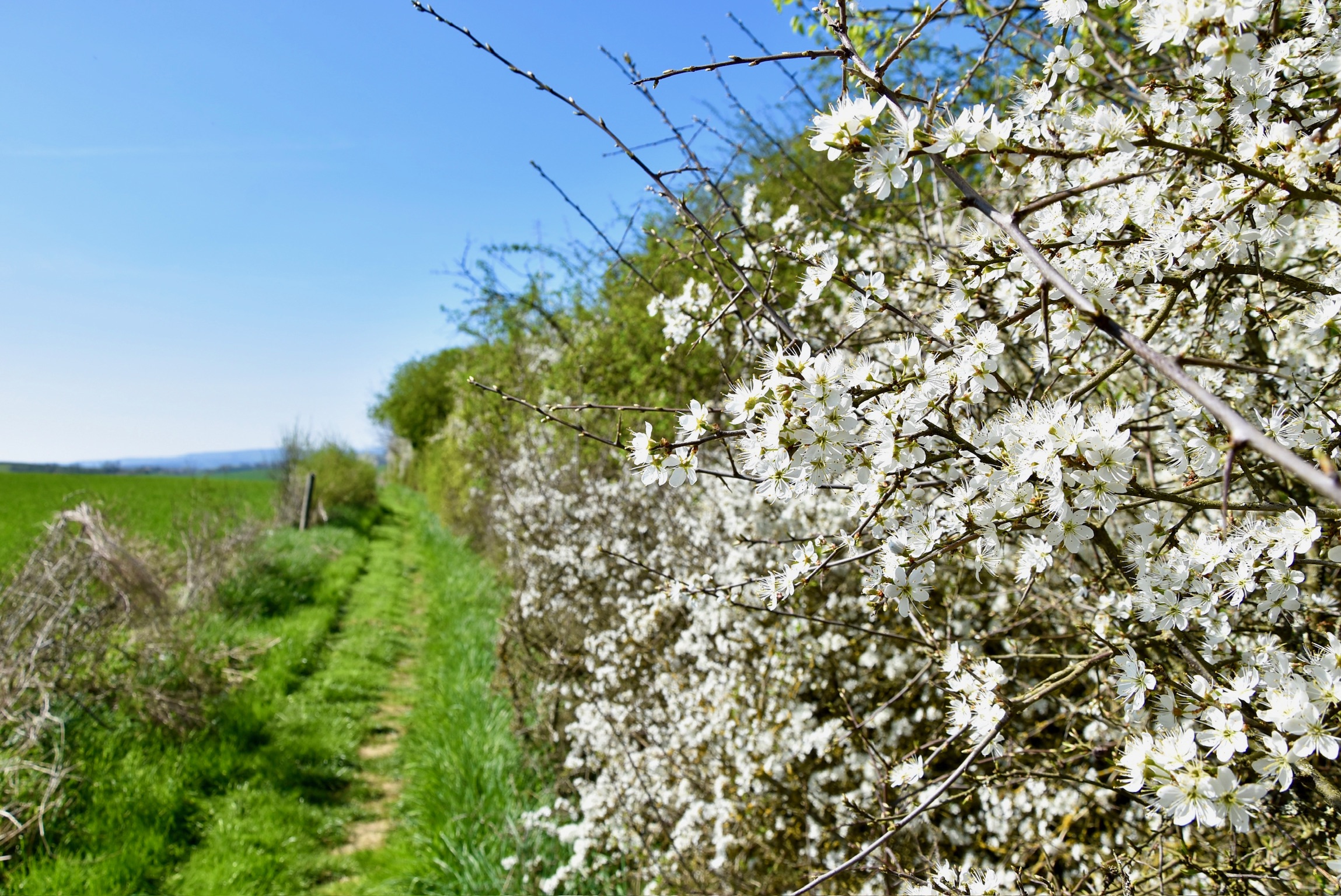
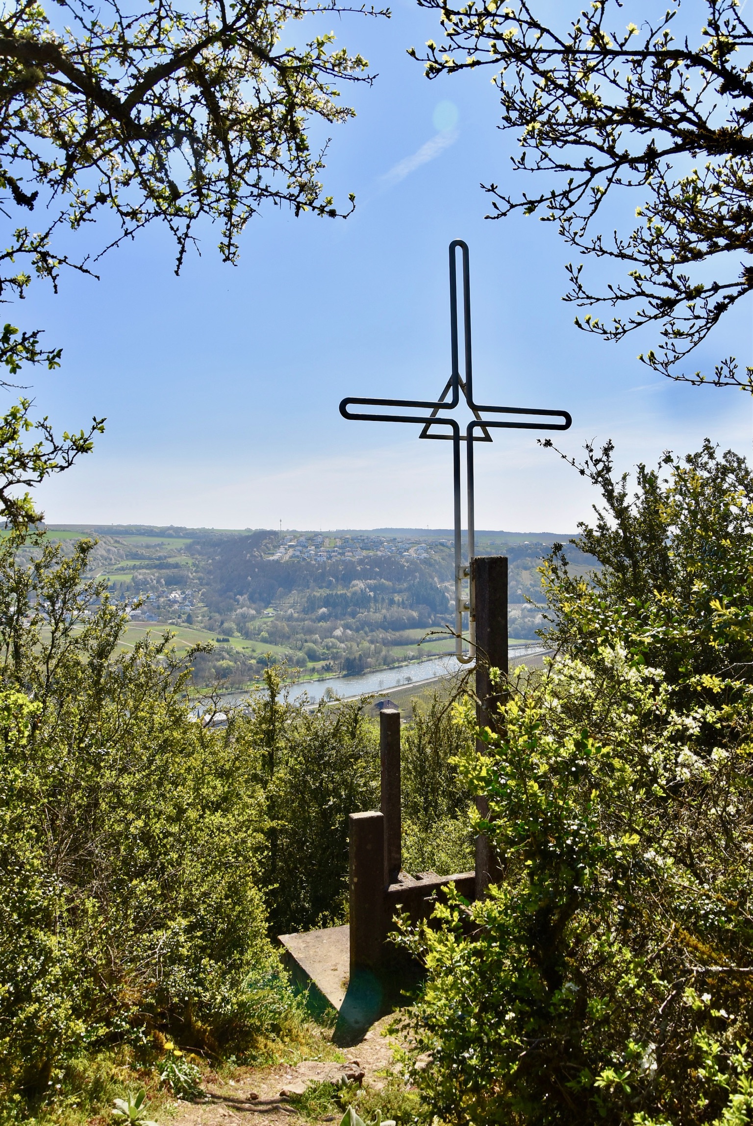
By the time your breathing has become regular again, the sights start to come thick and fast. A pretty natural hedgerow of voraciously blooming hawthorn frames magnificent views over the village of Niederdonven. A few quick turns and you’re striding towards the Moselle again, into a shrub forest on the “Palmberg” itself. A giant cross appears suddenly through the boxwood on a rough out-of-place concrete base, standing guard over the vineyards and villages below.
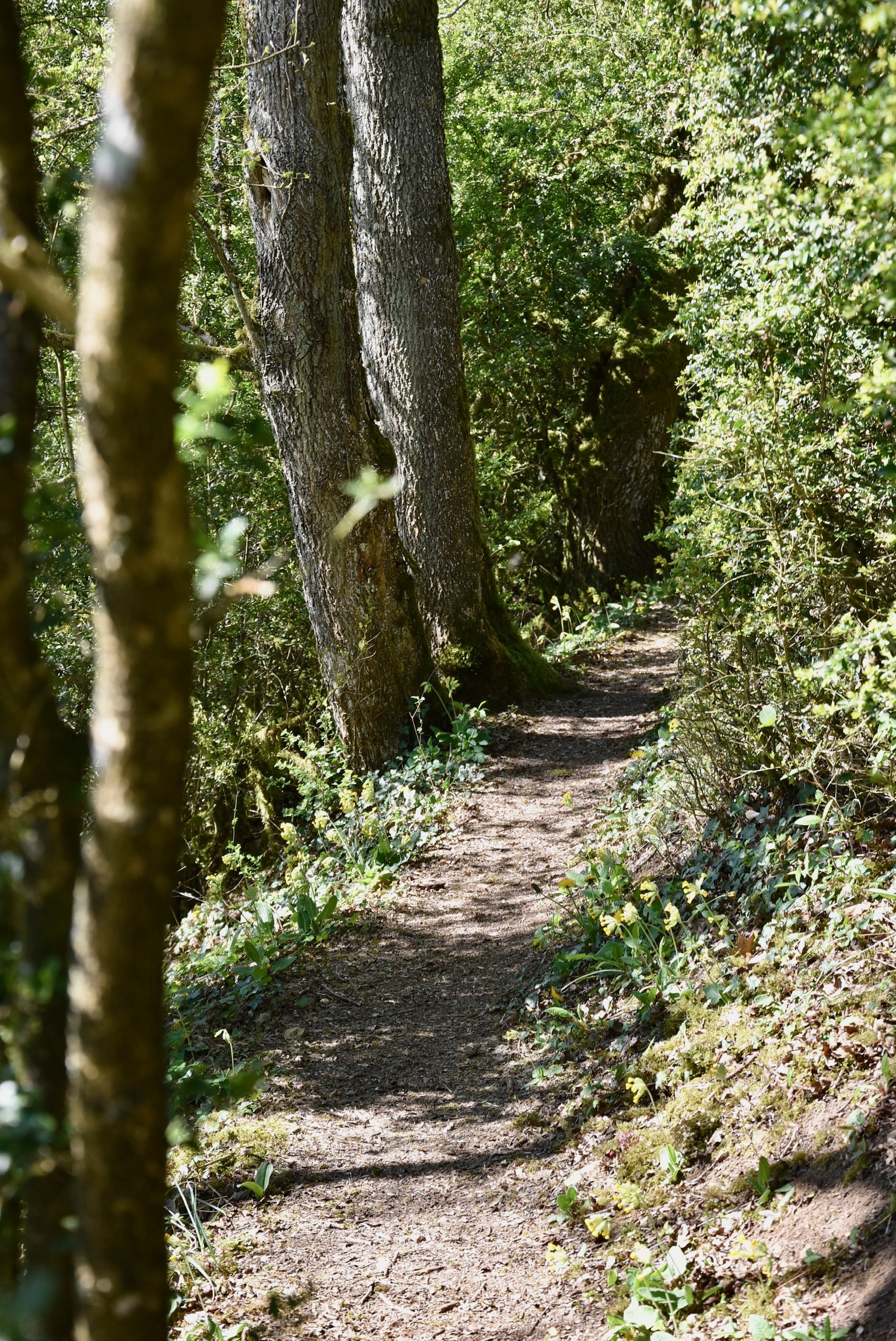
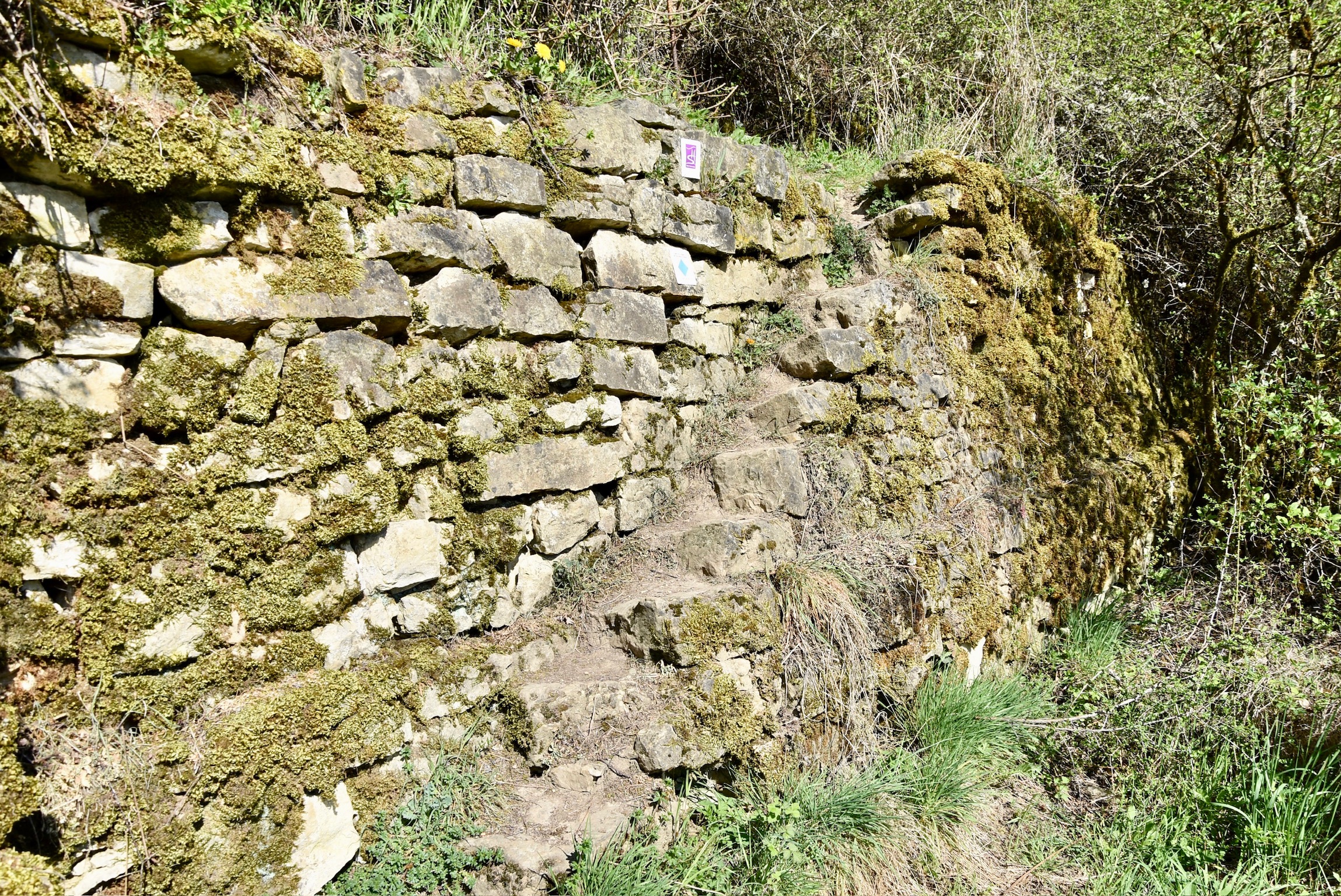
If the first section of the hike is characterised by the vineyards and the second by the open plateau, then the third belongs to the forest and water. After traversing an abandoned farm, the trail enters the Donverbaachtal, a narrow canyon with a gushing stream and mini-waterfalls everywhere. This is technically the toughest part of the trail; storms and flash floods over the past few years have made the path indistinct in places and rough almost everywhere. On several occasions, the trail crisscrosses the hurrying stream, but there are no permanent bridges. Expect narrow planks of wood and boulder-hopping; come prepared with waterproof footwear and perhaps a walking stick for balance.


Upon leaving the canyon there is a glimpse sideways to the “Palmberg” plateau, then an undulating path through forest and vineyard back to the starting point. It may be less than 10km long, but this trail certainly packs a punch, both in its natural (and man-made!) beauty, and on the physical challenge that it represents. Don’t underestimate either.
Links
- Visit Luxembourg official page
- Our Komoot track
- On Geoportal
(c) 2025 Jonathan Orr

[…] Traumschleife Palmberg – 10km – Intermediate […]
LikeLike
[…] mentions to the fabulous Traumschleife Palmberg and Circuit du Lac trails, which didn’t quite make the list this time. Curious to see what […]
LikeLike