

- 17km of hiking joy starting from the gorgeous village of Esch-Sauer (Esch-sur-Sûre).
- With 500m+ of aggregated ascent, this is a moderately challenging hike that should only be attempted under good weather conditions and physical fitness.
- Park and start at Place des Jardins. Bus stop: Esch-Sauer, An de Gäert.
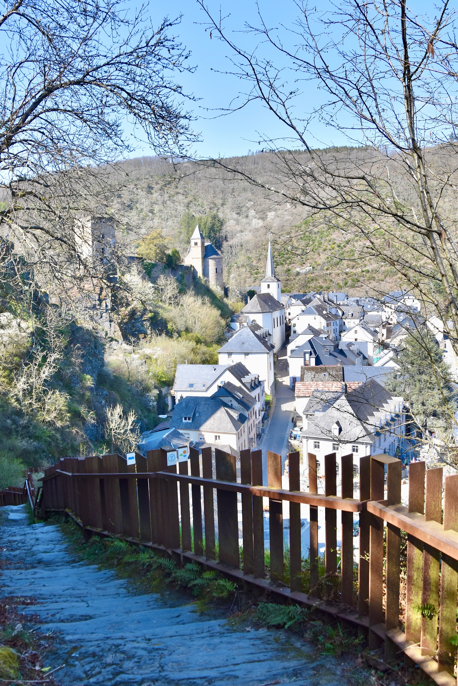
If there were awards given for viewpoints in Luxembourg, this trail would feature heavily. First of all, it would have a very decent chance of winning in the category “Best Viewpoint Over a Village“, which you can see in the cover image above, and plenty of other spots around Esch-Sauer.
And I think that it would absolutely wipe the floor with any competition in the “Best Viewpoint From a Bench” category. I mean, really, how can anything compete with THIS?

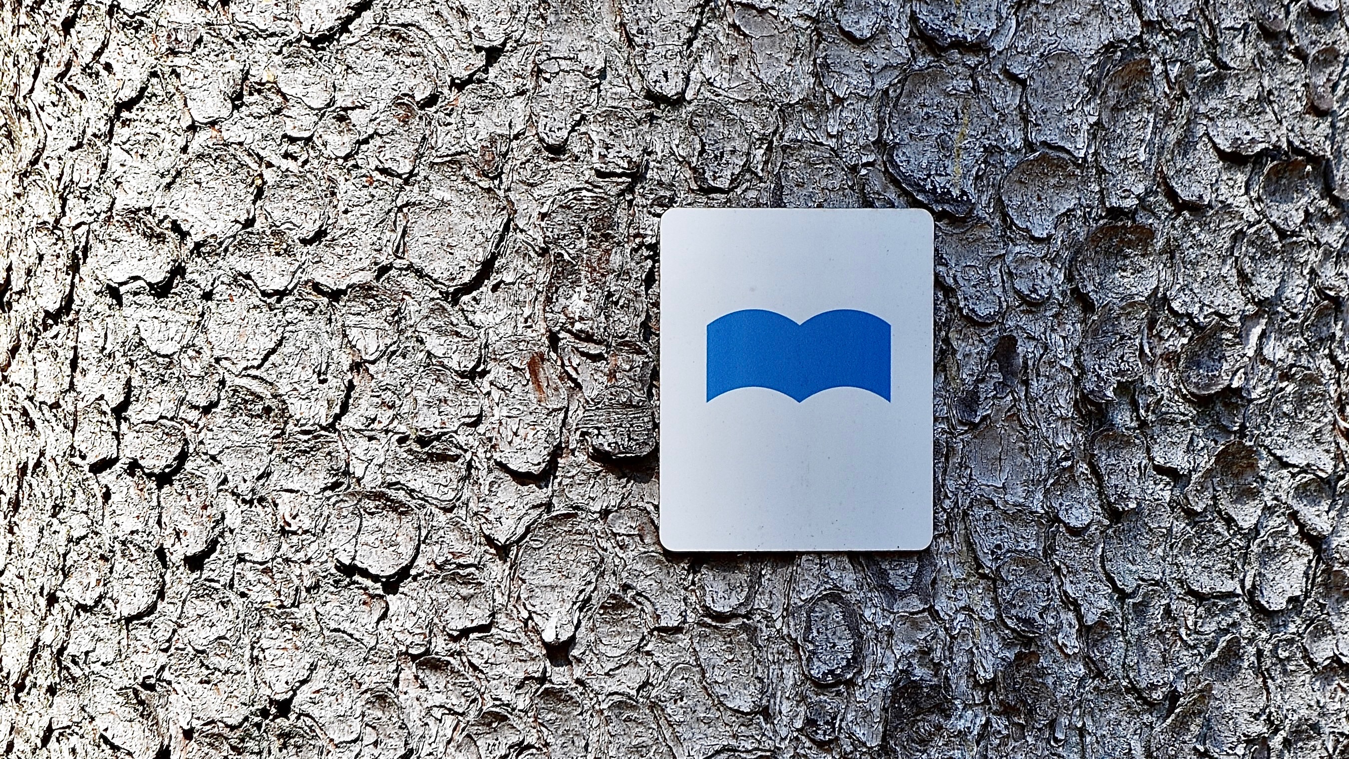
The Circuit du Lac trail, marked clearly with a blue symbol that resembles – perhaps oddly – a book, starts with a warm-up horseshoe loop around Esch-Sauer. Better get your camera out right from the start, because the views are sublime. It then almost goes into the village, but loses heart at the very last moment and instead follows alongside the road leading to the “barrage“, the dam that creates the Lac de la Haute-Sûre (henceforth called the “Stausee” or simply the “lake” for brevity). This is (by far) the least interesting section of the hike and it’s good to get it out of the way quickly. Still, once the trail leaves the asphalt road and heads up into the hills, you do get great views back over the dam itself.

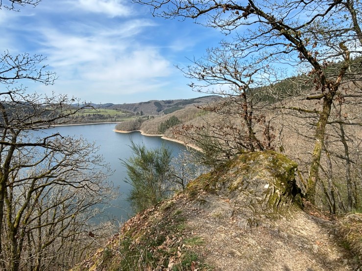
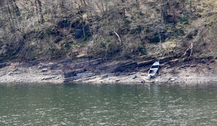
From this point onwards, the Circuit du Lac – Est is an absolute dream. You’ll be floating up and down on satisfyingly crunchy paths, with tantalising views over the lake regularly coming your way. After 9km, cross the pontoon bridge at Lultzhausen and – hey presto! – you’re on the opposite side of the Stausee and making your way back towards Esch-Sauer.
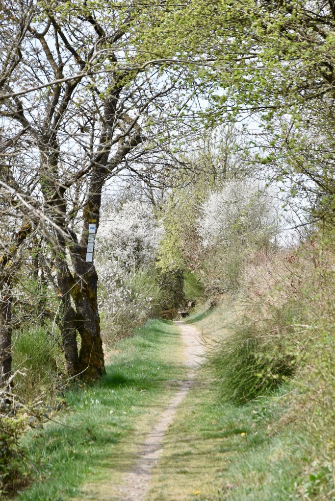


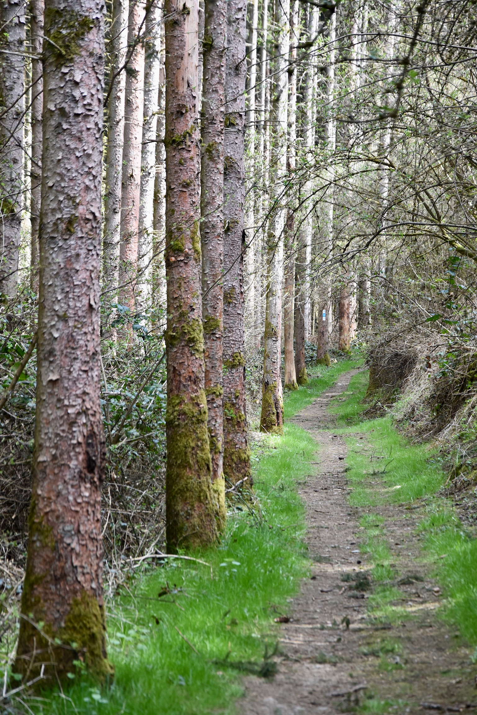
The south side of the lake immediately feels different to its northern counterpart. There are fewer grand vistas over the lake, less drama and a more varied type of vegetation. From Lultzhausen, the trail follows an easy path gently upwards on a sculpture trail before branching off into peaceful, birdsong-filled forest. From time to time the lake, of course, slides back into view, but its role has changed: star attraction to curious sideshow.
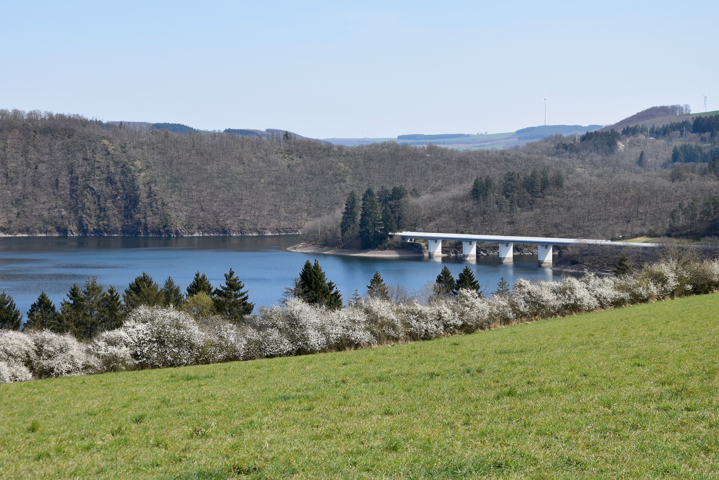

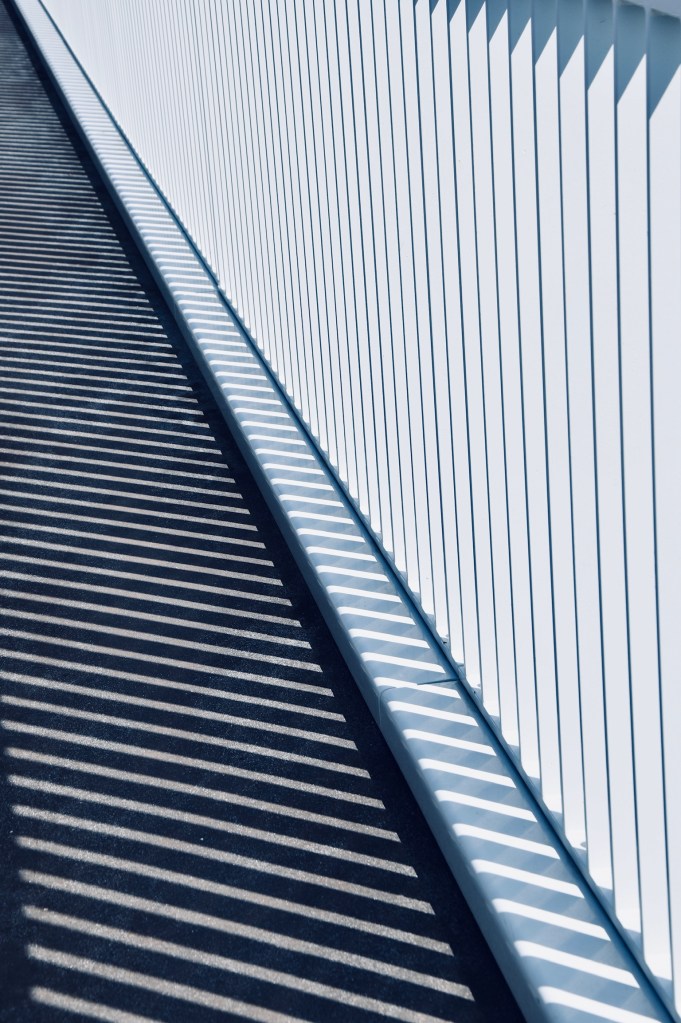
A brief, steep, rocky “lee” section, probably the most technically difficult part of the trail, leads you abruptly down to a gleaming-white road bridge between Lultzhausen and Esch-Sauer, where the sun was making geometrical patterns with the railings, oddly reminiscent of the Philharmonie building in Kirchberg,
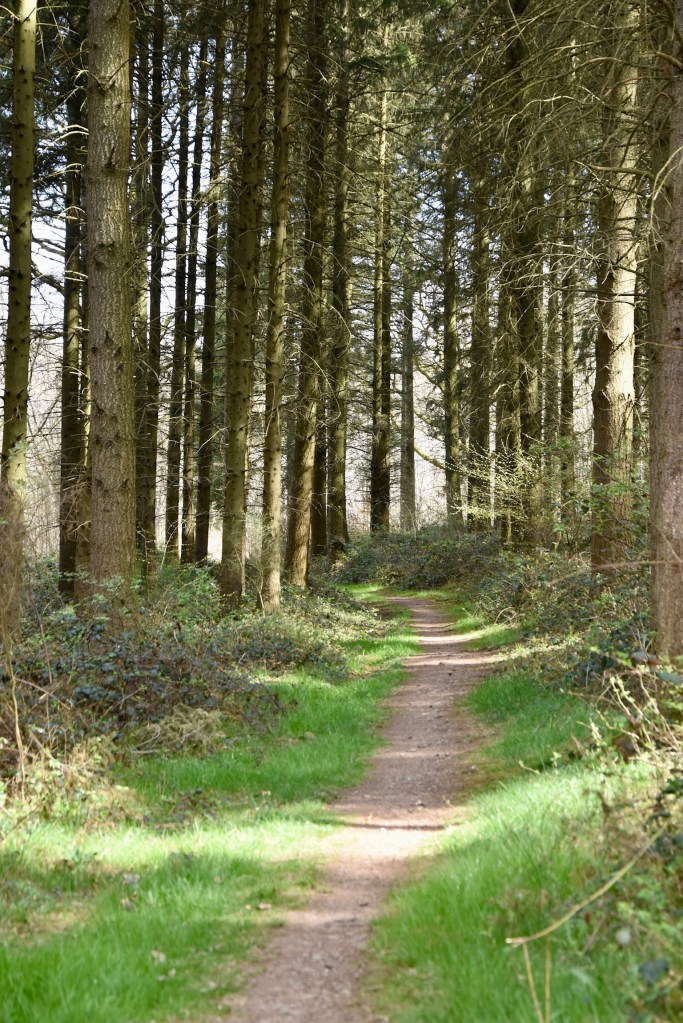
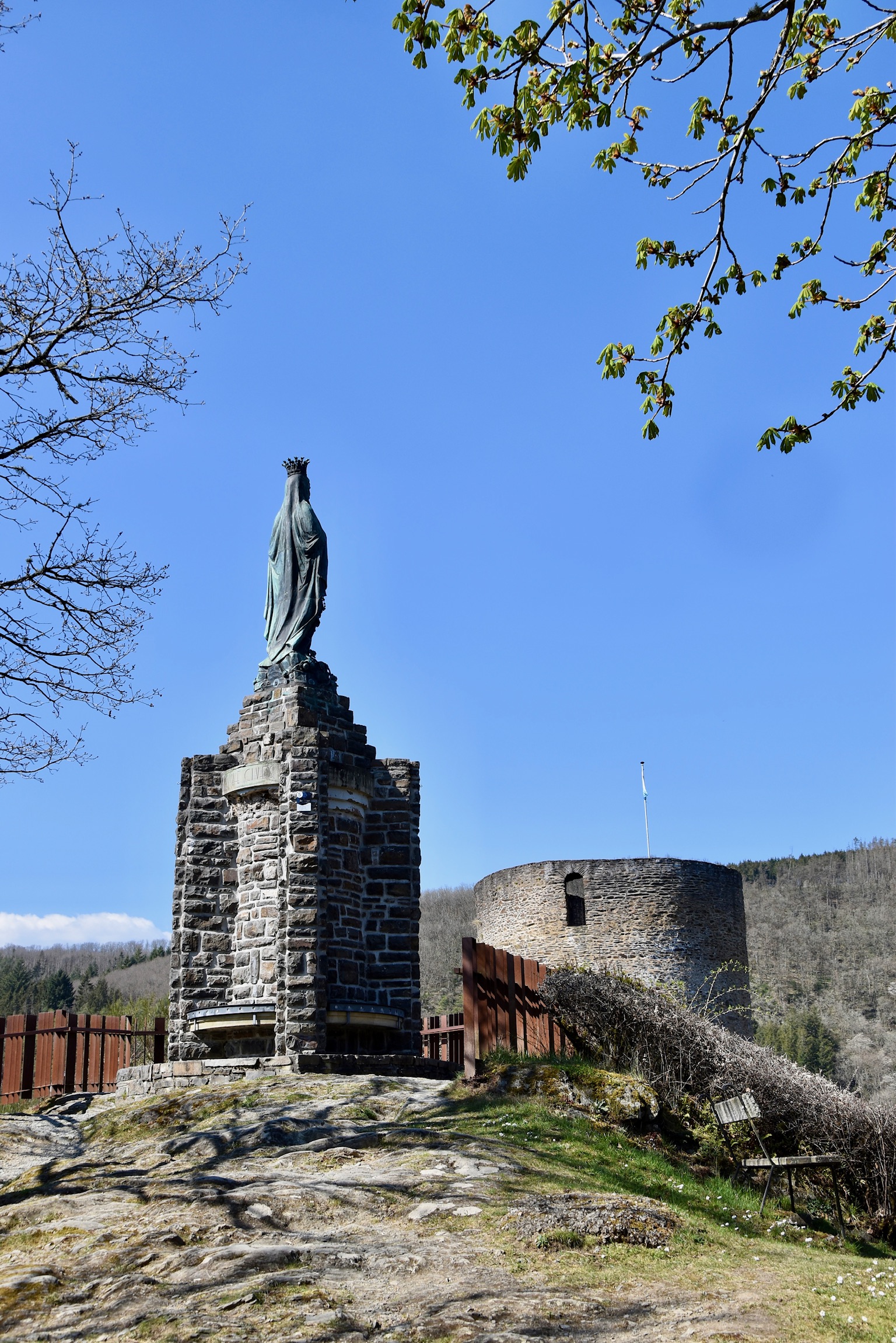
A quick right turn after the bridge, and the trail almost loses interest in the Stausee altogether, preferring instead to meander through forests of beech, oak and birch. It continues to rise and fall, testing those tiring muscles, until Esch-Sauer comes into view above the treetops once again. But don’t relax too soon! The “Circuit du Lac” doesn’t descend slowly into the village as expected, but instead pushes upwards one final time to the glorious viewpoint at the “Statue de la Sainte Vierge“. The photo opportunities over the village are, once again, utterly irresistible.


Back in Esch-Sauer, there are plenty of places to enjoy a well-earned drink or ice cream before returning to the starting point and, if you’re like me, already dreaming of taking on the longer “Circuit du Lac – West” sister trail in the near future.
Links
- Official website.
- Our Komoot track.
- The trail on Geoportal. (Note: this states that the aggregated ascent is 800m+, which I believe is incorrect. It’s more like 500-600m.)
All photos and text (c) 2025 Jonathan Orr

[…] mentions to the fabulous Traumschleife Palmberg and Circuit du Lac trails, which didn’t quite make the list this time. Curious to see what DID make it? Read […]
LikeLike
[…] hikes: Circuit du Lac (East), Eislek Pad […]
LikeLike