
- 16km – Challenging – 4-5 hours
- A moody forest loop dropping from the heights of Heinerscheid into the Our Valley.
- Highlights include two excellent viewpoints over the Our Valley and poignant traces of WWII.
- Public car park near Hotel Cornelyshaff, 83 Haaptstrooss L-9753 Heinerscheid.
- By bus: Heinerscheid Geméin
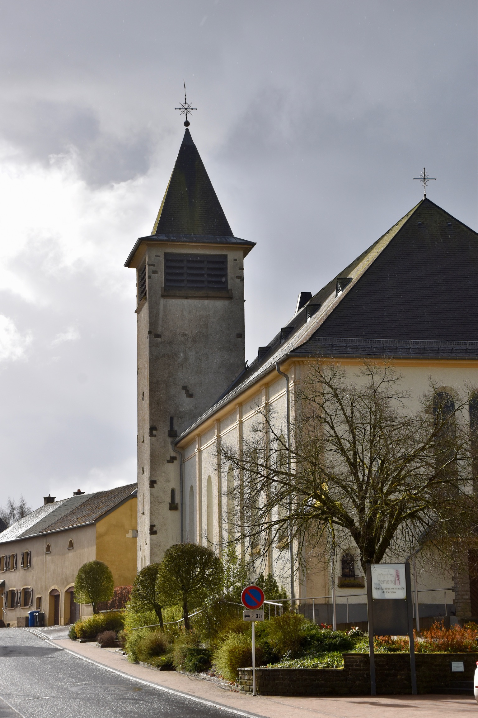
Heinerscheid, a little north of Clervaux*, perhaps isn’t the most spectacular village in Luxembourg… but it certainly greeted me with a bang.
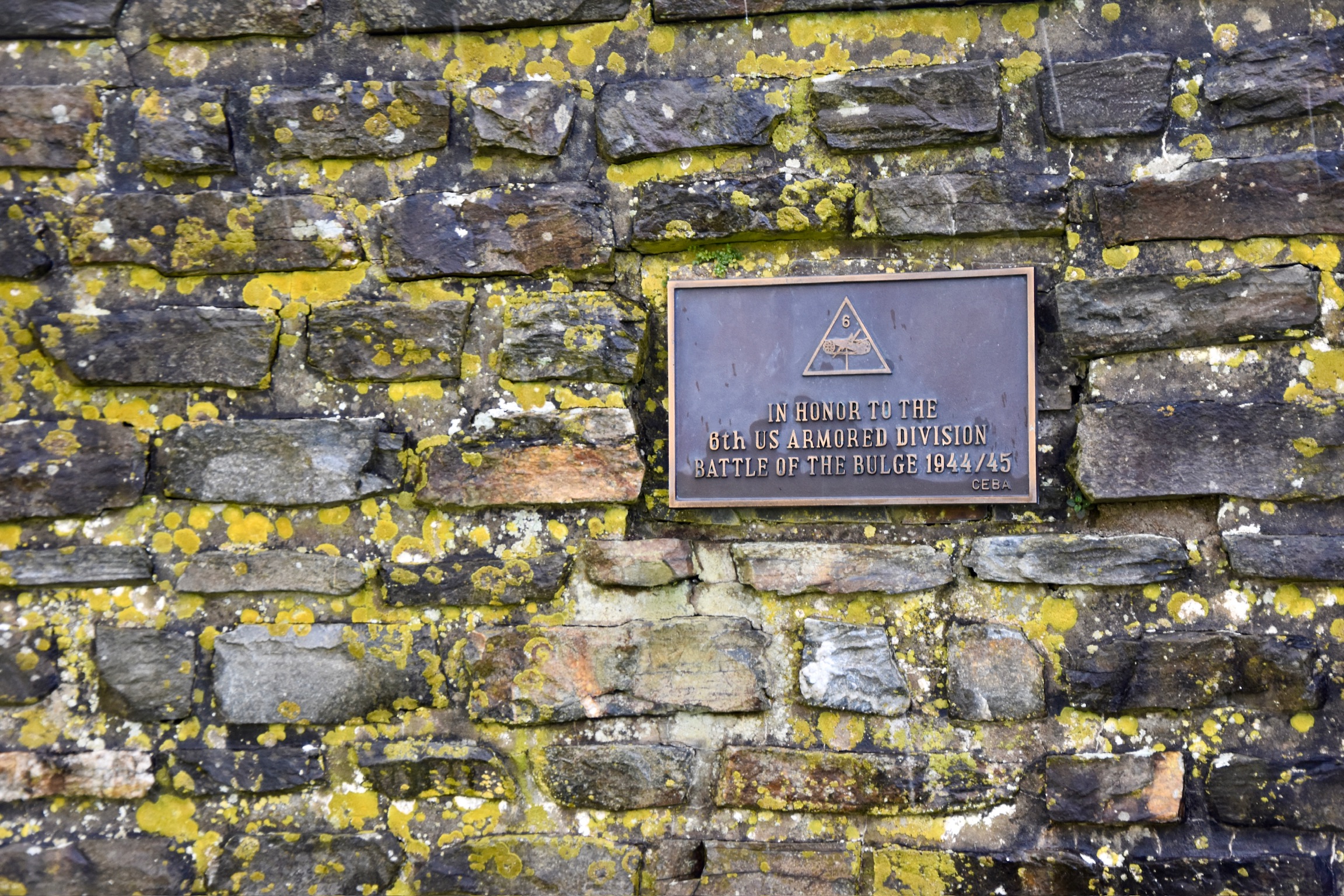
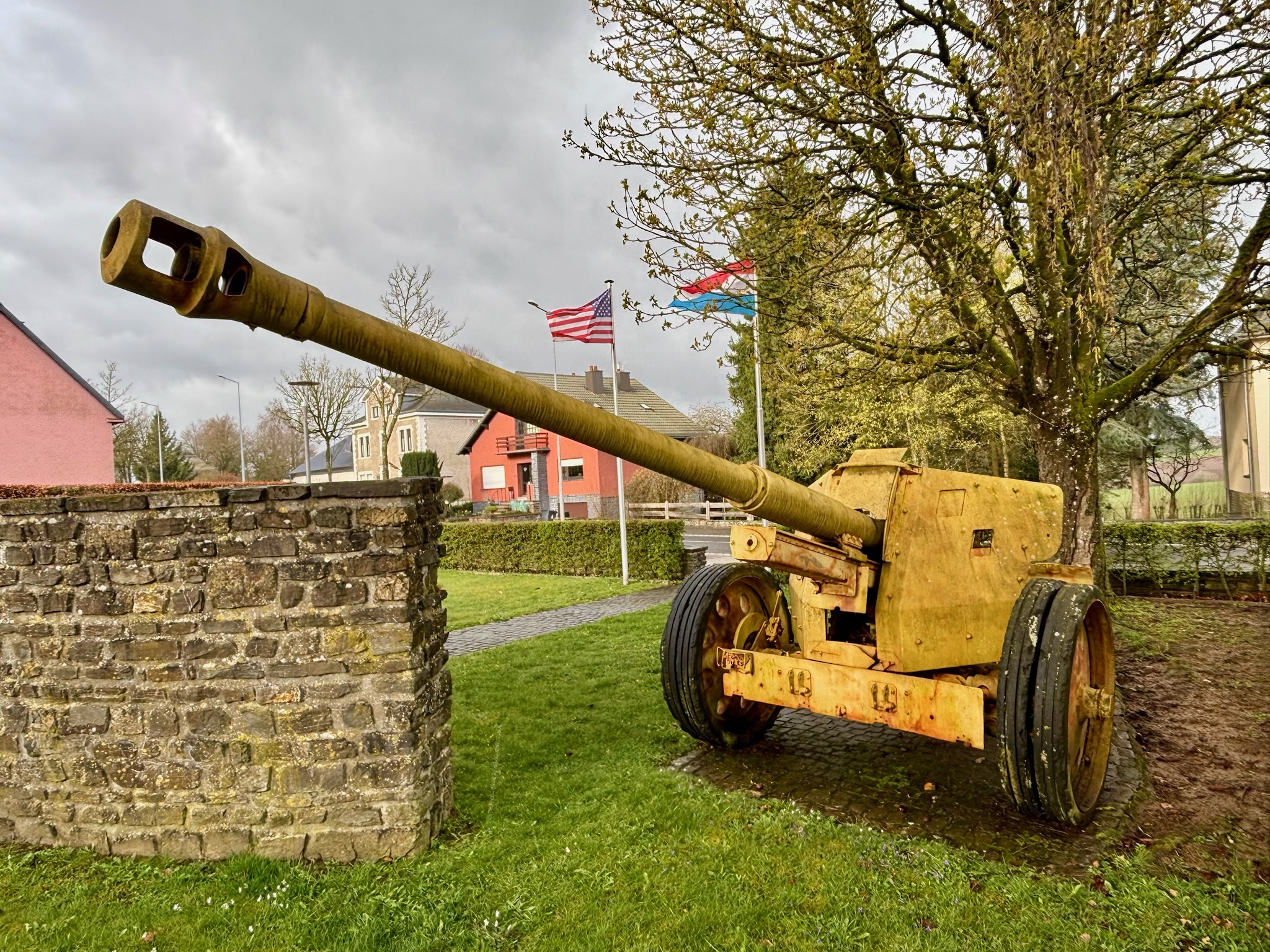
The morning’s blue sky began to cloud over ominously as I approached, and by the time I entered the village, all hell was breaking loose. Thick, fat raindrops and hail pelted my windscreen, and cherry blossom was being ripped from the trees by a vicious wind. As I passed a monument to the Battle of the Bulge – American and Luxembourgish flags whipping furiously in the maelstrom – my nose inexplicably started bleeding profusely. Quite the entrance.
At least this gave me a good excuse to sit the storm out. By the time I had returned to the monument on foot ten minutes later, everything was relatively calm and peaceful once again.
Spoiler alert: it didn’t last.
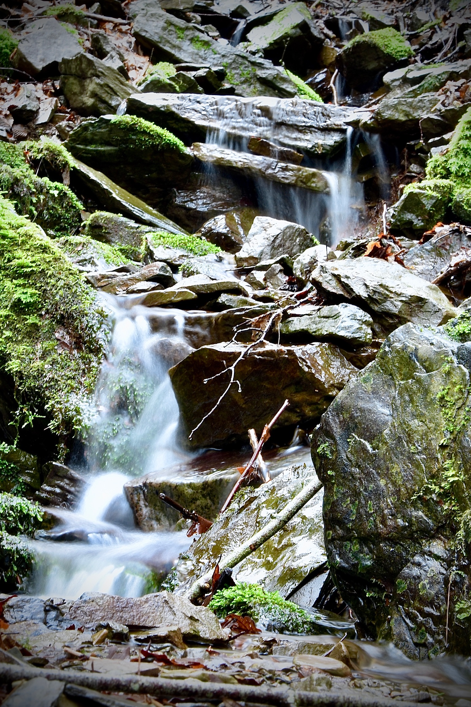
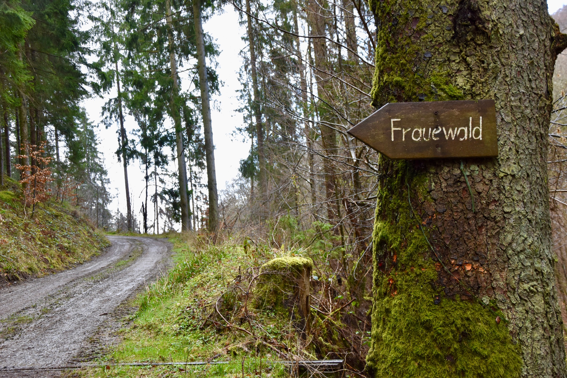
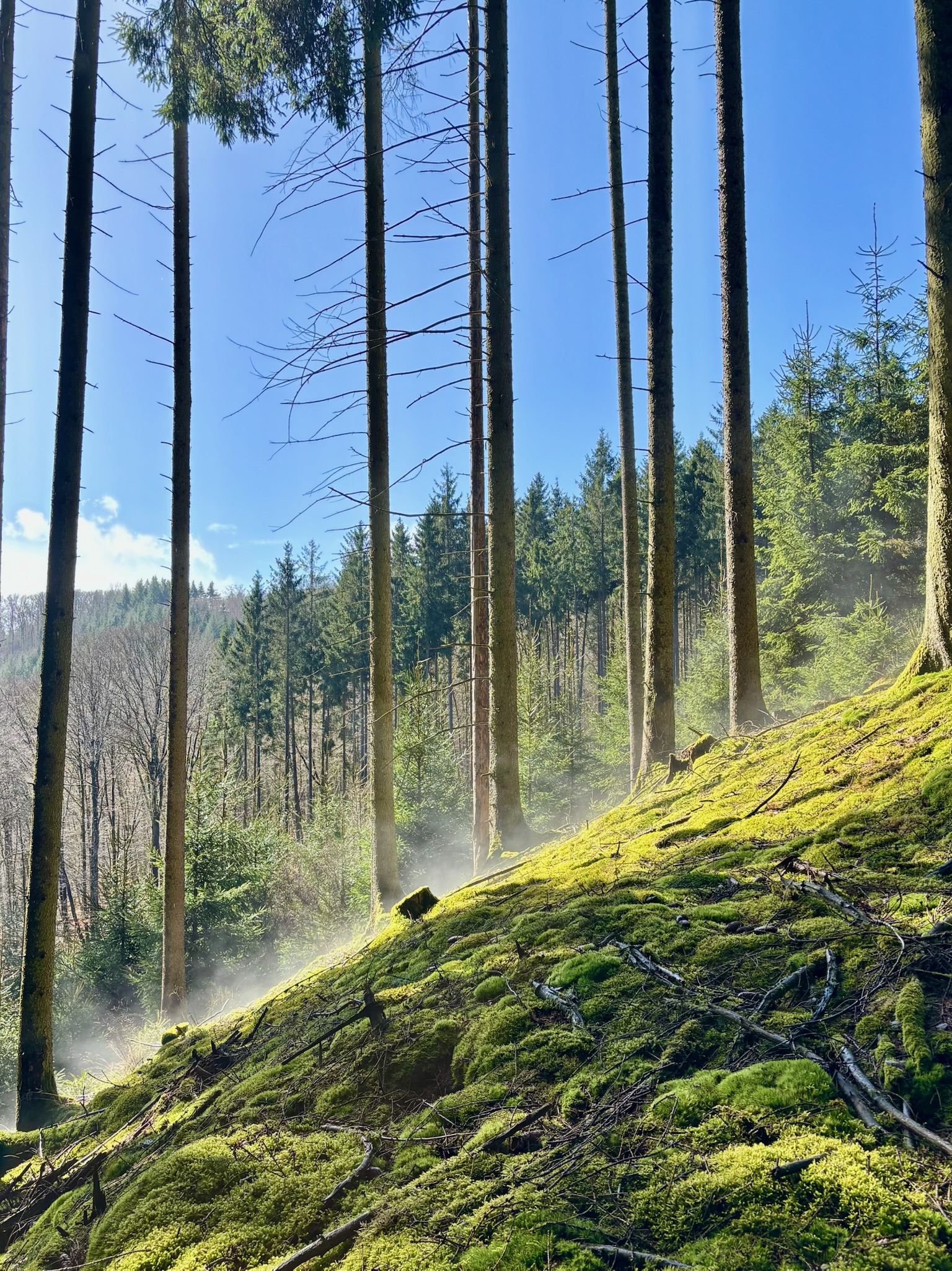
From the memorial, the route wastes little time in dropping away from Heinerscheid, descending steadily into forest, the commotion of the world receding with each step. All sounds of civilisation soon faded, replaced, this spring morning, by birdsong and the constant murmuring of a stream to my right. The sun had come out now, dappling light on March-green mossy slopes rising steeply to my left. It was lovely.
Senses heightened by this sudden immersion in nature, I noticed that the wood anemones, in riotous bloom now in the Guttland and Mullerthal, weren’t fully out yet here in the Eislek, where winter holds its grip longer than elsewhere in the country.
Immersed in my thoughts, this private world of calm reflection was abruptly shattered by a logging truck, growling past me on an impossibly narrow track. As it disappeared over the hill behind me, silence settled quickly once again. It turned out that truck driver would be the only human I would see for over 11km.
And where there aren’t any humans, there is little need for phone signal. For the next two hours, my phone stubbornly showed nothing but a little satellite logo; if it’s a digital detox you crave, this trail is an excellent choice.
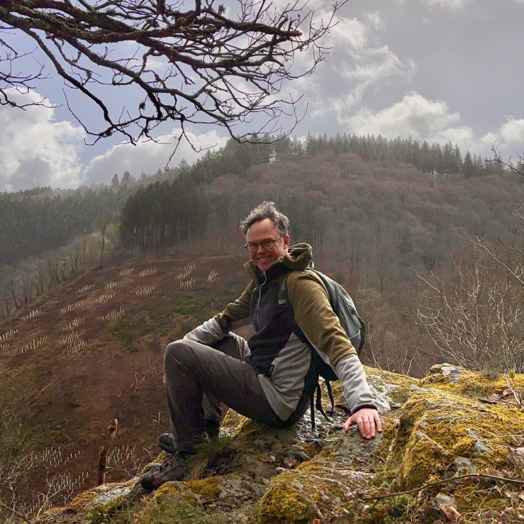
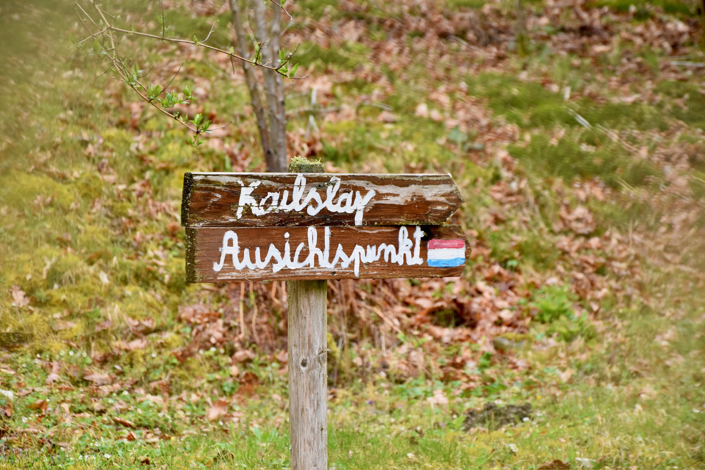
After crossing the stream and tackling a short climb, the steep wooded hills on the German side of the Our began to loom into view, and a sharp descent down the Kasselslee opened up ahead. Picking my way down this slope, I came across a place familiar to me: a rocky bluff perched high over the brooding river. It’s where I took the photo four years ago that has served as my profile picture on this very website ever since. I genuinely didn’t know that it was here; sheer dumb luck to stumble across this glorious spot again.
About thirty seconds after that photo was taken, Mother Nature switched the lights off again. Heavy raindrops began pelting down from a threatening sky. I fumbled into my raincoat and continued the tricky descent, before joining the trail along the river. The wind, which until that point hadn’t really been an actor in this play, now ripped down the valley, driving stinging rain into my face. Dark, muddy puddles appeared everywhere, and for about thirty minutes, my world shrank to putting one foot in front of the other and seeking, vainly, for cover.
I thought I might find some shelter in a “bunker” signposted at the bottom of the lee, but just as I approached it – BAM! – on came the lights again. The sky switched from menacing black to purest blue in an instant, and the sunlight came streaming through the trees once more. As I tackled the short scramble to the bunker itself (where, as it turned out, there would have been no shelter anyway), steam started rising from the ground all around me, an instant evaporation of the huge amounts of water that had fallen. I don’t think I’ve ever seen anything quite like it.
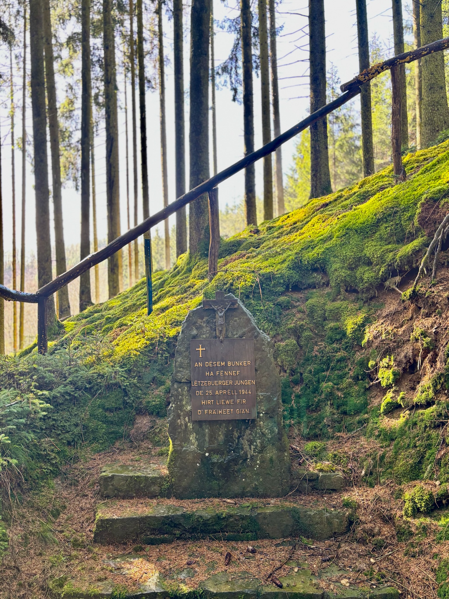
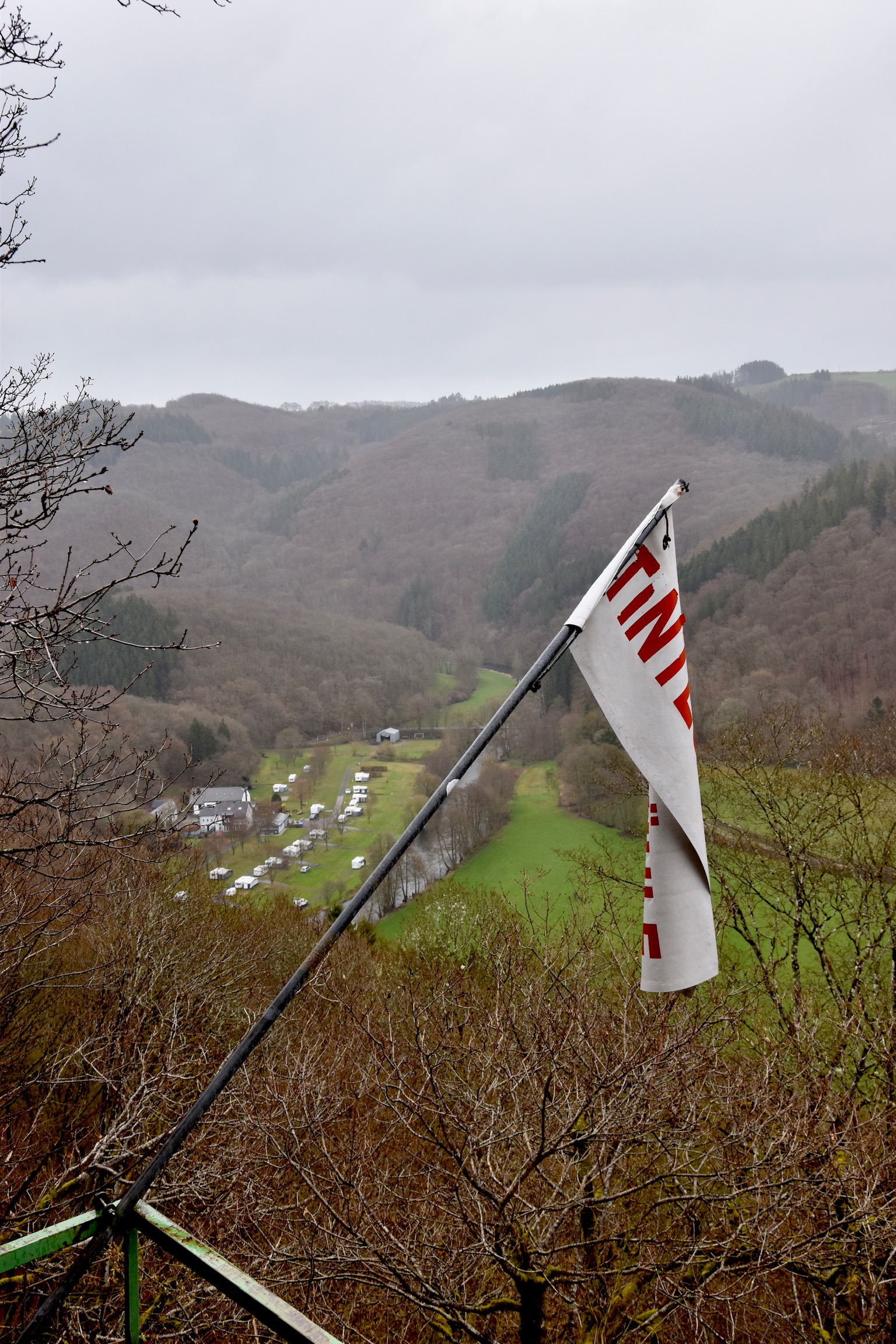
If I’m being honest (and the bunker aside), the river section of this hike was a little disappointing. For the most part, the trail sits well away from the water (you can barely even see it) and the underfoot conditions were very muddy. By this point, the lack of phone signal was also beginning to frustrate me as I was expecting an important email. I began to look forward to arriving at the Tintesmuhle campsite where, I assumed, the presence of tourists would guarantee some 4G at least.
I was wrong.
Absolutely zero reception at Tintesmuhle either, so I pushed on immediately up the steep valley wall to the second major viewpoint of the day – the Kailslee. The weather had settled into a flat grey drizzle by now, but it’s easy to imagine how good this spot must be on a clear summer’s day, with sweeping views over a languid bend in the Our. As I admired the vista, my phone started pinging furiously; two hours of messages all arriving at once. I opened my flask of coffee, replied to the urgent stuff, then set off for the last 3km back to the car.
The return to Heinerscheid felt like a full-circle moment, almost mirroring the start of the hike but in reverse. Now, as I climbed, the mossy forest of arrow-straight fir trees lay to my right, and the babbling – by now gushing – stream to my left.
Soon, this too was left behind as I re-entered the village…
… where it began to snow.
All photos and text (c) 2026 Jonathan Orr
*Yes, you can go further north in Luxembourg than Clervaux.
