

- One of the very best hiking trails in Luxembourg: a classic Mullerthal loop with magnificent scenery and castle views.
- 11km circular trail – Hiking boots strongly recommended.
- Park and hike directly from the castle car park (free of charge).
- By bus: Beaufort, Op der Gare, then follow signs to the castle.
Fairy-tale woods, imposing rock formations, dizzying viewpoints, fading memories of WWII, arguably the most beautiful river in Luxembourg and, of course, THAT castle. The B1 is perhaps my favourite hike in all of Luxembourg.
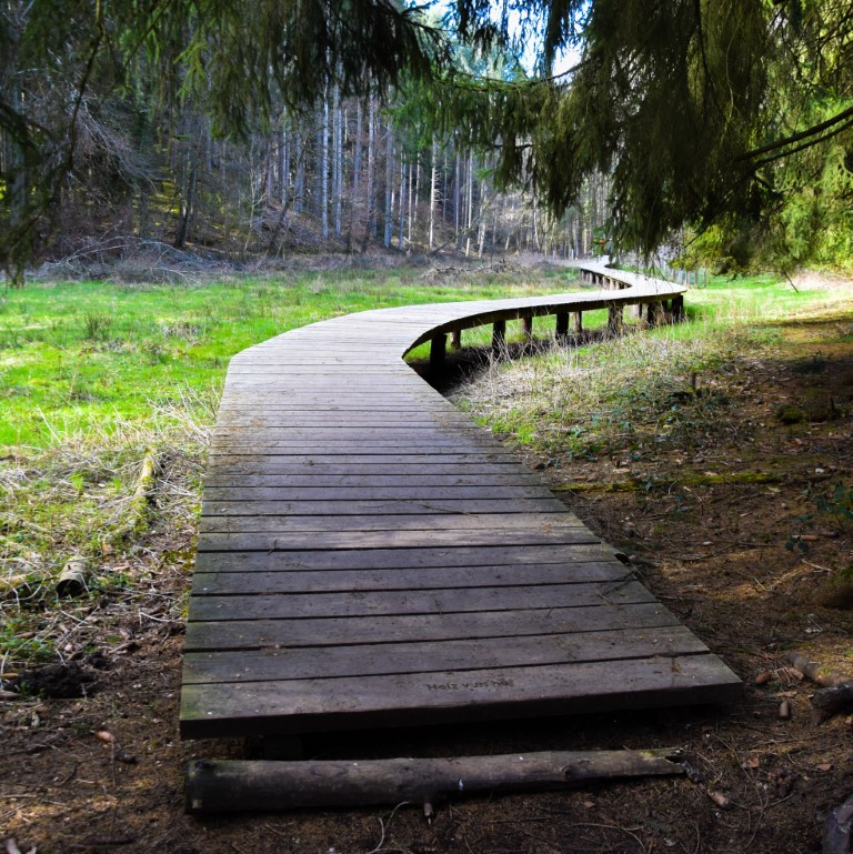
From the car park, enter the castle grounds and start along the well-trodden path. Soon, immediately behind the castle in fact, an area of wetland is bridged by the elegant curves of this wooden walkway.
It’s a good start, and it keeps on getting better. Onwards the trail continues through typical Mullerthal forest, skirting Beaufort campsite before crossing two small roads. Here begins one of my favourite stretches of the trail – the slow descent through the “Birkbaach“. It’s pleasant – but nothing special – at the top, then the path gets narrower, rockier and prettier as you descend. Look out for the unusual boot-smoothed burrs of tree roots peppering the path.


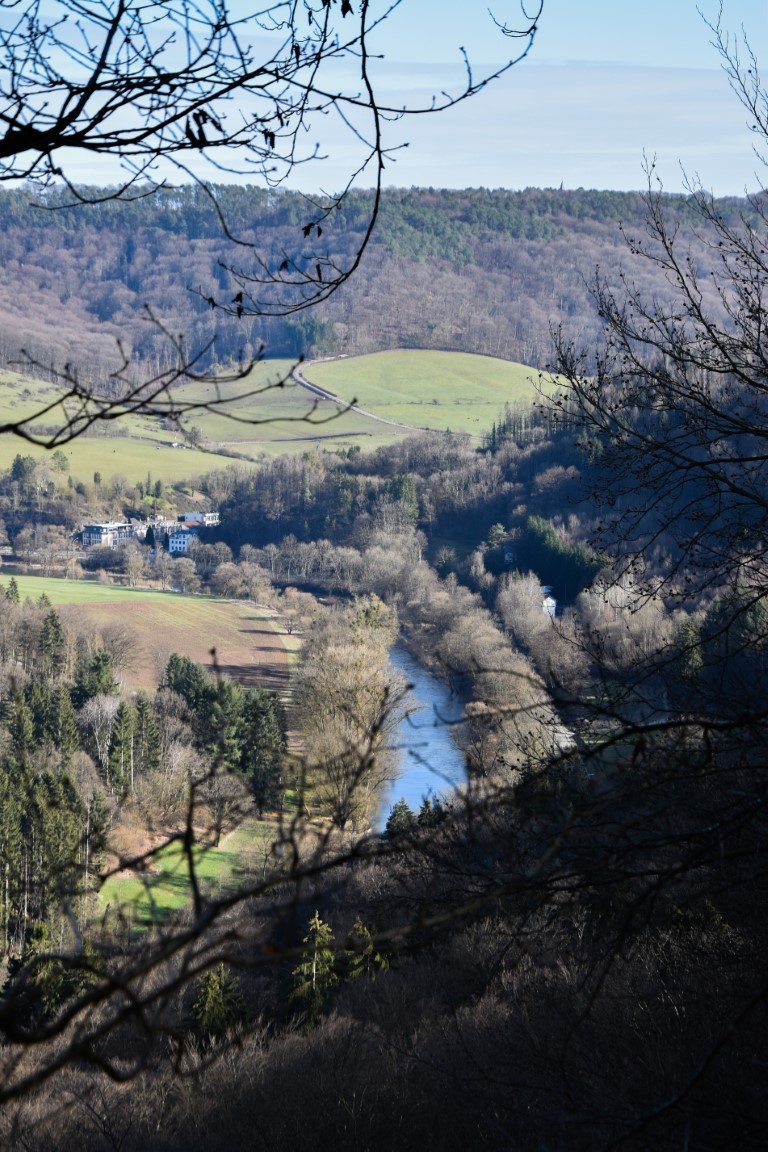
After crossing the Beaufort-Dillingen road, the trail rises sharply up to the ridge of the plateau overlooking the Sauer valley, taking in a couple of exceptional viewpoints:
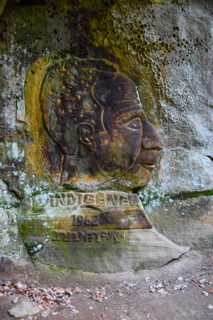
It is between these viewpoints, on the very edge of Luxembourg itself, that something truly extraordinary can be found: World War II tree graffiti.
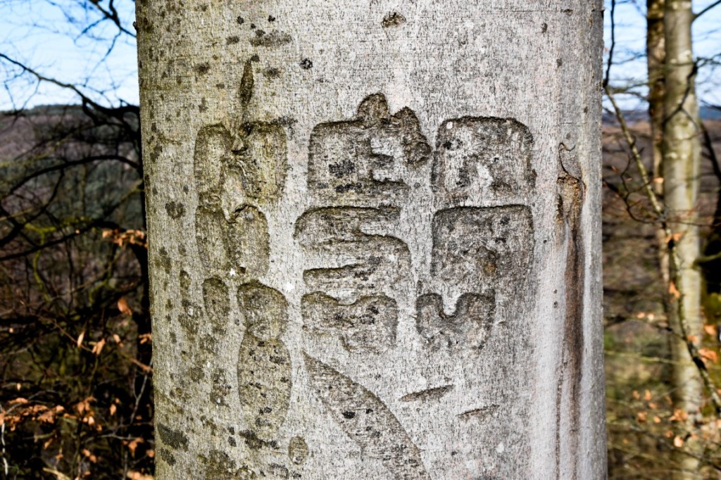
This has been carved by an American soldier during the Battle of the Bulge in winter 1944/45. In fact, for a stretch of a few hundred metres along this trail, you can find several of these messages from the past, carved into the now-mature beech trees. Many of these little wartime souvenirs must, of course, have been lost over time, but others still remain. It’s utterly fascinating to look for these unique treasures, these real-life but rapidly fading ghosts of 1944.
TIP: The WWII tree graffiti is much easier to spot in dry weather. If you reach a point where the path leaves the cliff edge near a picnic table, you have missed them. Retrace your steps for a hundred metres or so and look again.
UPDATE 2025! Four years after originally having written this article, the tree graffiti is fading fast. It is still visible in places, notably the one in the photo above, but it won’t be around for much longer 😦
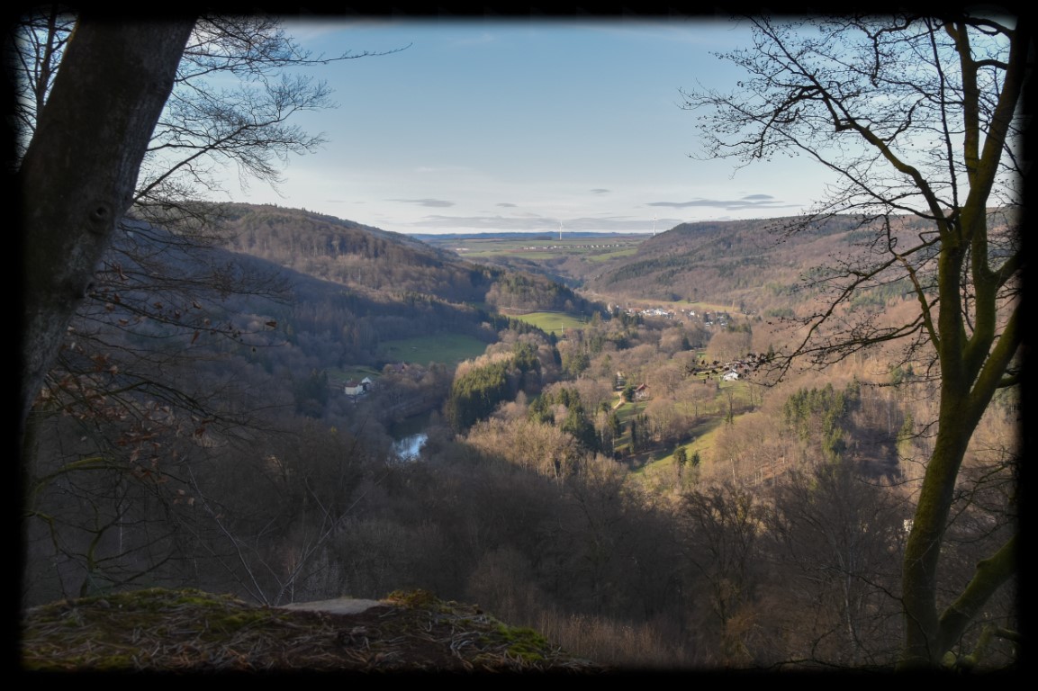
The trail continues through fairy-tale Mullerthal scenery until the third viewpoint – and the best of them all!
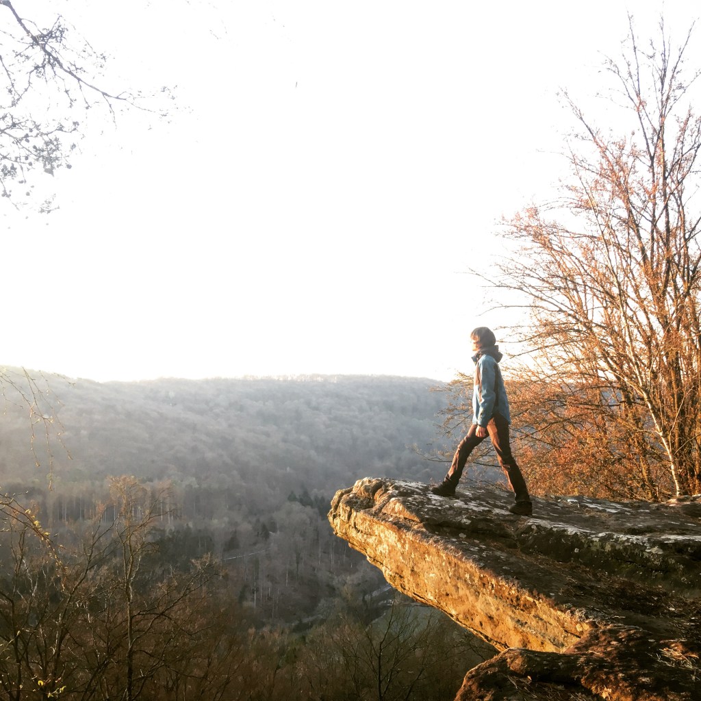
This is the “Köppeglee“, Luxembourg’s equivalent of Norway’s famous “Trolltunga“. Not for the faint-hearted (nor children). But be careful not to miss it because, inexplicably, this A-list viewpoint is not signposted! After having hiked about 7km clockwise from the castle, look out for a path to your left at precisely the spot in the photo below, and walk for about 100m.

Turn left here!


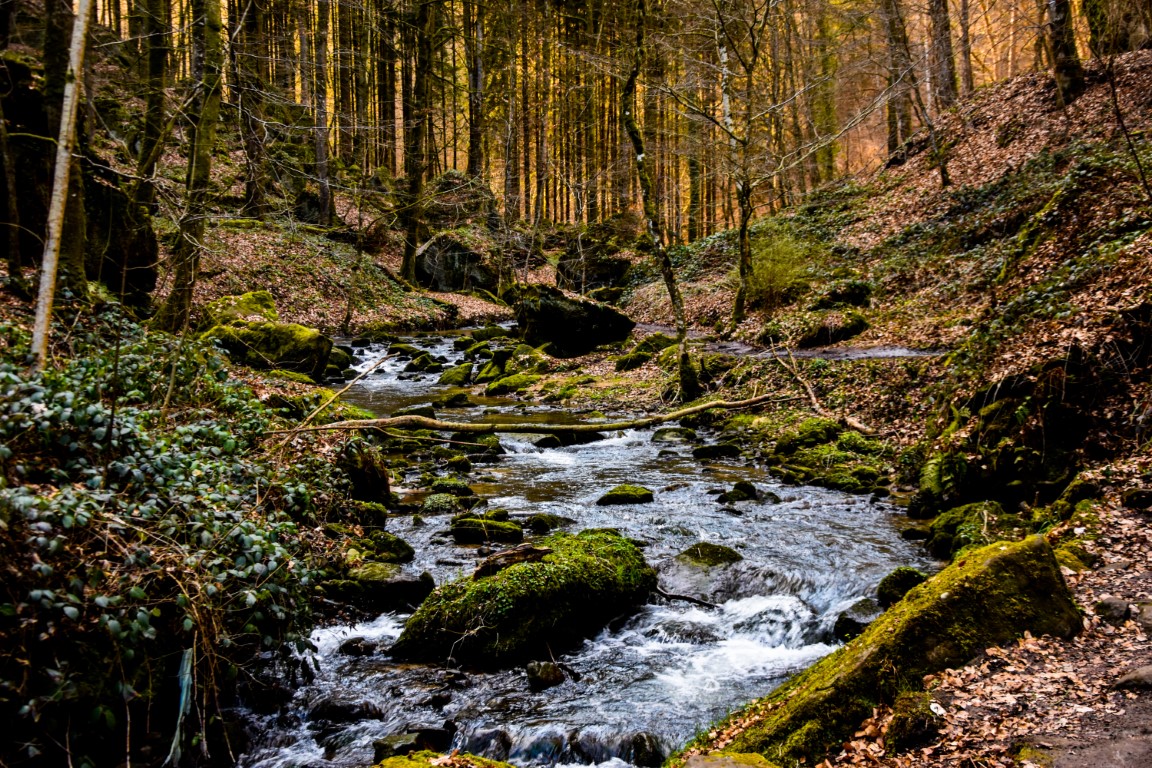
Onwards goes the trail, through typically wonderful landscapes of rock and tree, until you descend to perhaps the most beautiful place in all of Luxembourg – the magical Hallerbaach Valley. I could write for a thousand years and never come even close to matching Robert J.Casey’s poetic description of this place in his 1924 book, The Land of Haunted Castles.
The quiet vale of the Hallerbach beckons the wanderer. Plush mosses and ferns as countless as the laces of Brittany carpet its shadowy rocks… In such a place as this the nymphs of woodland and brook live on undisturbed by the political cataclysms of the centuries.
Indefinitely the watery guide leads on through a wonderland of shrub and stone that stops the clock and dims one’s eyes to landmarks. There is no time. There is no distance.
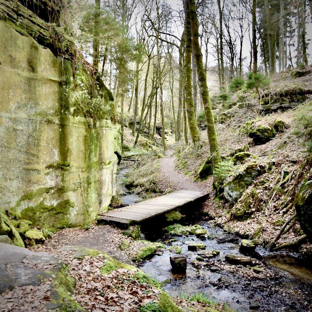
Mesmerized by the gurgling of the stream and the constant twittering of the birds, you’ll then make a sharp right turn and begin to climb back towards the castle. Leaving Hallerbaach behind, you enter the utterly different but equally beguiling Haupeschbaach Valley. Robert Casey, of course, has something to say about this place too:
Then suddenly the veiling flowers and mosses fall away. The rocks of the glen stand huge and gaunt and naked in the sun like Titans dipping into the little river like a bath. […] Taupesbach (sic), cascading over its rocks, beckons to a grimmer canon.
100 years later, and the Haupeschbaach valley still feels wilder, more savage than its Hallerbaach cousin. The path here starts off with good intentions, but quickly becomes gobbled up by the untamed waters of the rushing stream. Bring waterproof boots and a good sense of balance in order to avoid soggy feet, particularly after periods of rain.
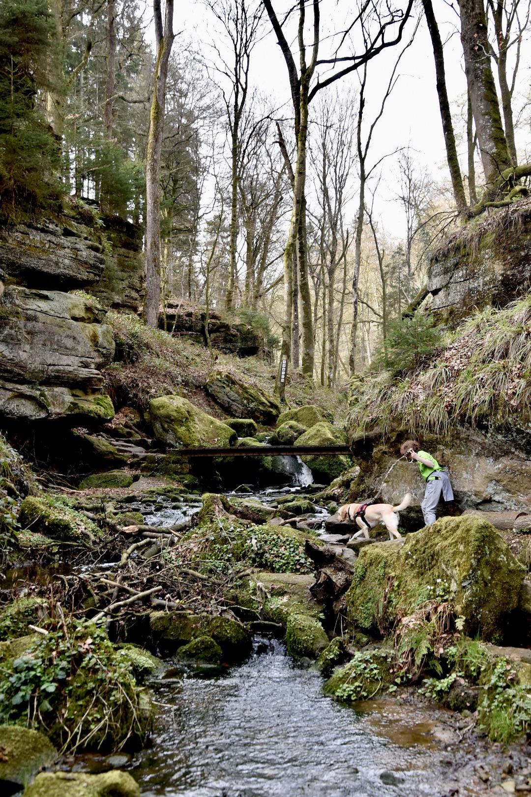
The valley opens out somewhat before reaching the castle, almost appearing somewhat tame and unspectacular compared to its lower reaches, but there is one more curiosity before your hike is complete.
Of all the approaches to Beaufort Castle, the one from the lake in the Haupeschbaach valley is surely the most impressive, and a fitting end to one of Luxembourg’s great hikes.

Links
All text and photos (c) 2021 Jonathan Orr

[…] 3) Beaufort B1 […]
LikeLike
[…] simply, a delight. You are basically now following one of the sweetest sections of the brilliant B1 trail, only in the opposite direction. A brief taster of classic Mullerthal rock scenery, followed by a […]
LikeLike
[…] a longer – and even better! – hike, try the Beaufort B1 instead; easily one of the top five hiking trails in […]
LikeLike
[…] B1 Beaufort – 10km – One of the best hikes in Luxembourg, no question. […]
LikeLike
[…] #2 B1 Beaufort – 91/100 […]
LikeLike
[…] changes abruptly when you reach the Biirkbaach, a section of the B1 trail near Beaufort with an almost other-worldly beauty. Rocky bluffs, scattered boulders, weather-smoothed roots and […]
LikeLike
[…] rainures: mysterious grooves in boulders left by our distant ancestors (you can find more on the brilliant B1 Beaufort hike, either side of the […]
LikeLike