

Starting point / parking at Ettelbruck gare – take bus 550 or 543 back from Bourscheid Moulin – not suitable for young children.
With COVID-19 continuing to bite us hard, we are staying at home these Easter holidays… which gives my teenage son and I time to do something that – perhaps oddly – we have never attempted before: the celebrated “Escapardenne” Trail in Luxembourg’s hilly north.
Strictly speaking, there are two “Escapardenne” trails – the “Lee” trail from Ettelbruck to Kautenbach, and the “Eislek” trail from Kautenbach all the way to La Roche-en-Ardenne in Belgium – over 150km in total, around two-thirds of which lies within Luxembourg’s borders. With entry into Belgium currently not an option, our mission is to make it all the way from the gritty railway station in Ettelbruck to the featureless Lux/Be border at Hoffelt – but soaking up greedily the dramatic scenery in between.
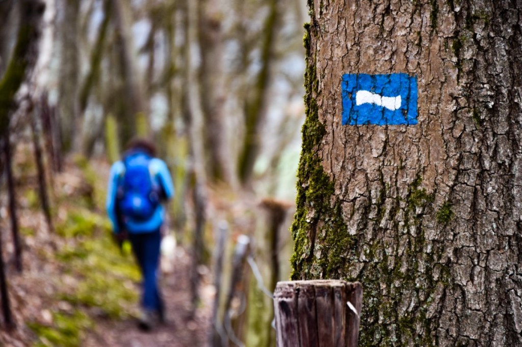
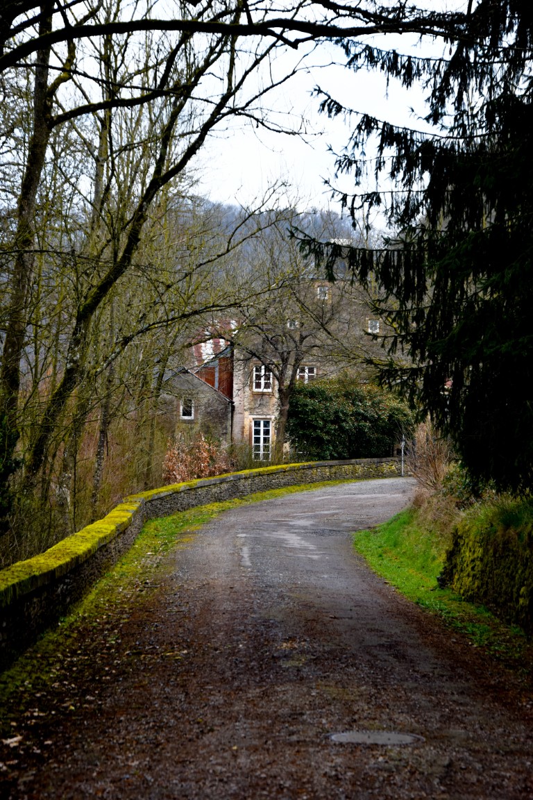
The trail starts off humbly, with a quick exit from busy Ettelbruck and through some fairly typical woods before descending into the quiet streets of Erpeldange. Just as we were leaving the village, an elderly man greeted us from outside his picture-perfect traditional farmhouse. He cheerily asked us where we were heading, but when we told him he just shook his head ruefully and gave us an ominous warning:
“Be careful! Very beautiful, but dangerous. Wet leaves on steep, rocky paths. You need to watch your step!”
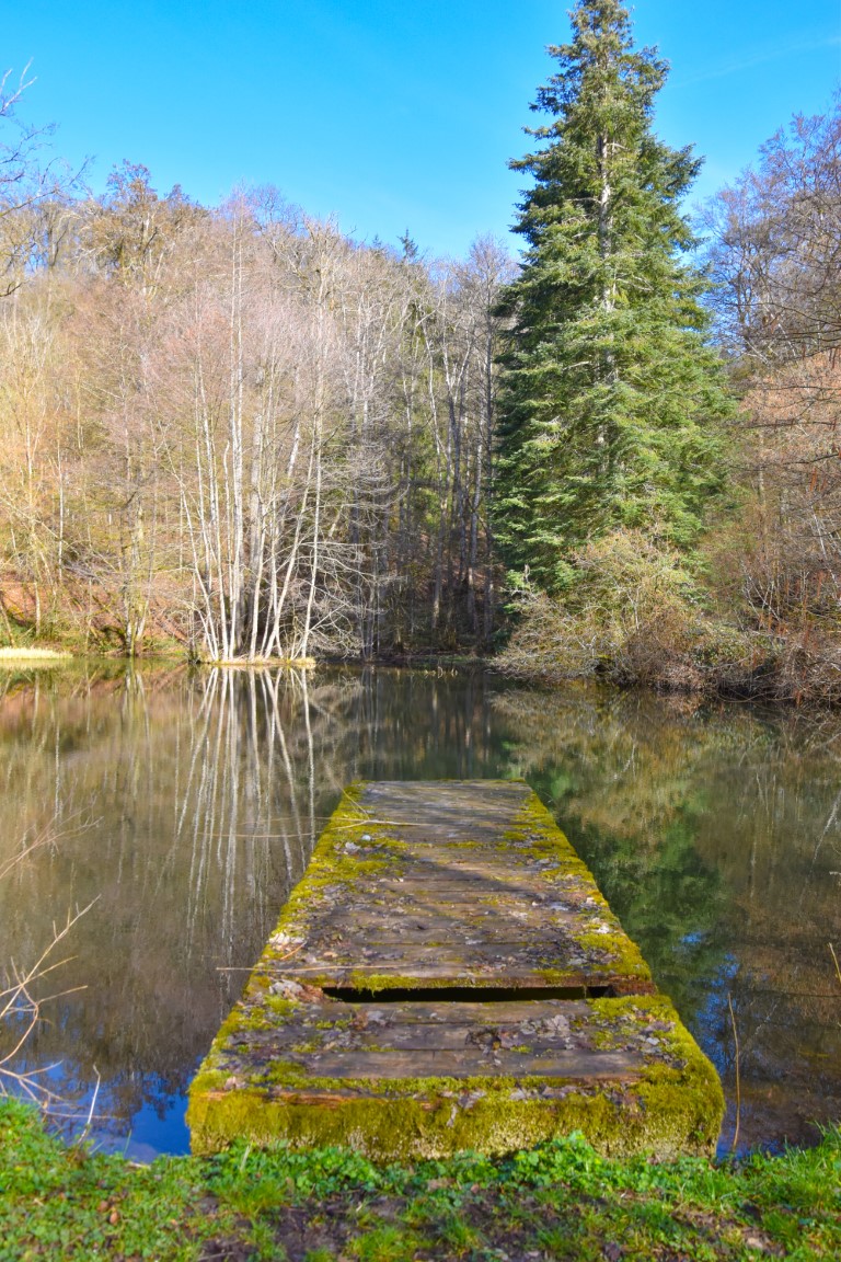
We thanked the old man and headed onwards, quietly becoming convinced that he must be crazy. After all, the path had been easy up until then and continued to pose no major difficulties as we climbed gently through birdsong-filled woods with murmuring streams and glassy ponds.
Then we began to approach the “Priedegtstull“… and the old man’s dire words came abruptly to life.
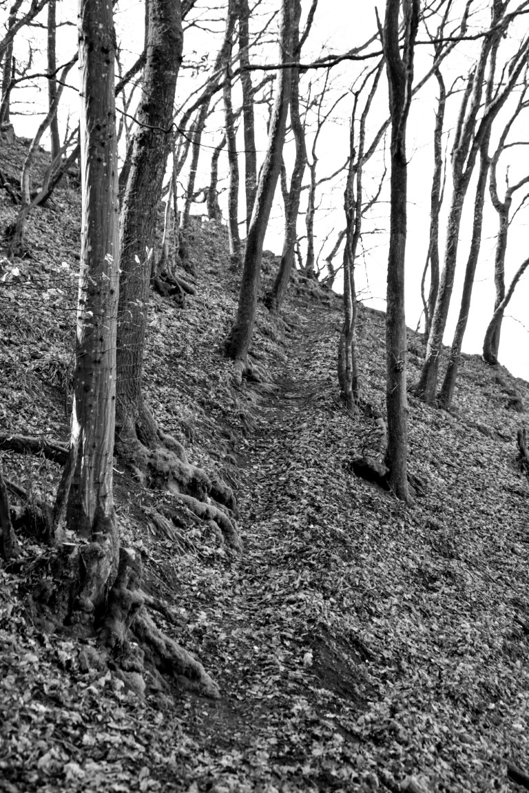
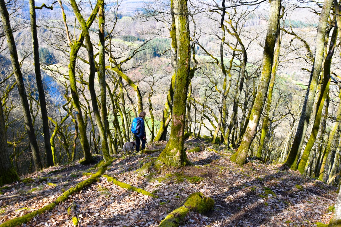
The path narrowed, the gradients tripled, the leaf litter was – indeed – remarkably slippery, and tree-covered outcrops of slate vanished over dizzying cliffs. Even the birdsong disappeared. The reward, however, was great.
We had intended to have lunch at the Priedegtstull but, not finding anywhere to sit that wasn’t on a 30-45% incline, pressed on up to the top of the plateau, where the whitewashed walls and fragrant spring flowers of the Closdellt chapel proved to be a much more appetising spot.
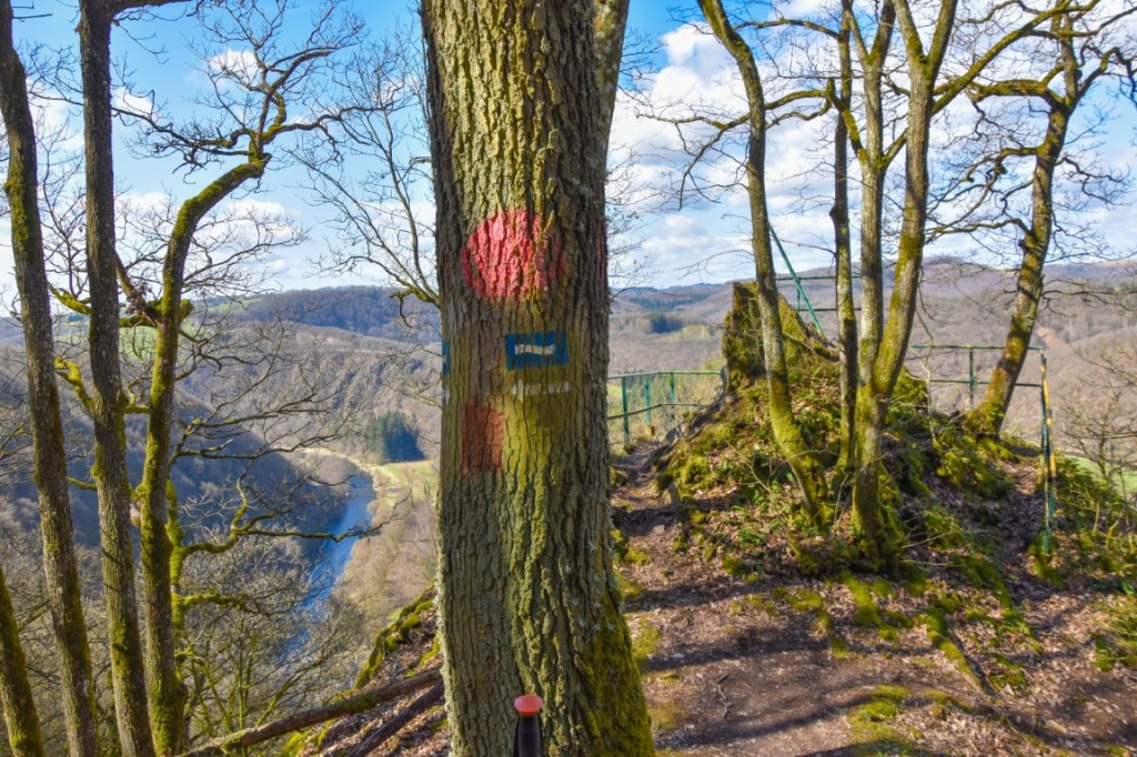
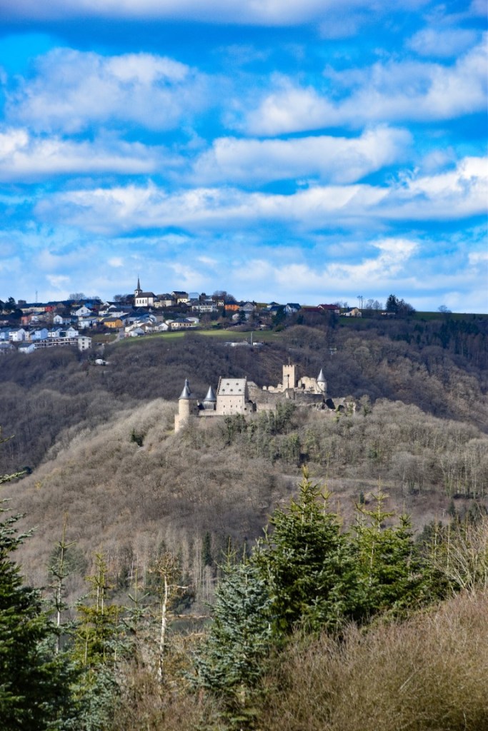
Little did we know it at the time, but the photo above of my son and the dog proved to be rather special – we didn’t see flat ground again for the remainder of the hike… From Closdellt, the path ducked downwards once again and it wasn’t long until we got our first glimpse of the brooding hulk of the famous castle, perched two-thirds of the way up a huge distant hill like the guardian dragon of Bourscheid itself.
Down, down, down we descended into Michelau, then immediately up, up, up out of it towards the highest point on the hike (Helkeshuuscht, 461 metres) and the approach to the jaw-dropping Gringlay viewpoint.
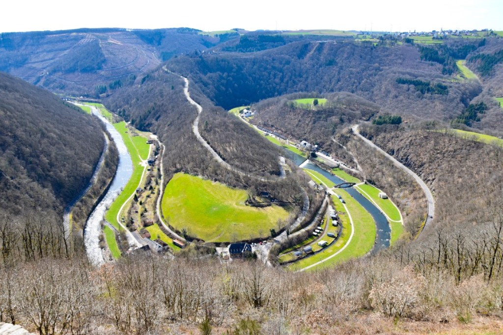
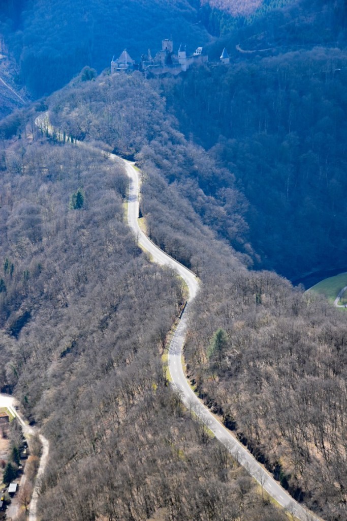
The endpoint of Stage One of the Escapardenne Lee Trail is the old water mill in the bottom-centre of the photo above – 230 metres vertically below the viewpoint, but a knee-destroying, calf-throbbing 900 metres on foot. To maintain concentration and balance after a tough day on the trails, I popped the SLR into my rucksack for the descent, meaning that I have no photo of this final path. So, instead, I’ll leave you with this: a zoomed image of the road from the water mill up towards the castle; a little teaser of the drama that awaits in Stage Two.
(c) 2021 Jonathan Orr

[…] hikes: Escapardenne Lee Trail Stage One, BS4 […]
LikeLike