- 9km* loop near Consdorf that quietly reveals some of the prettiest corners of the Mullerthal Trail… without the touristy bustle.
- Highlights include striking rock formations, particularly in the wild and wonderful “Ponteschgronn” valley.
- Park and hike by the church – 22 Route d’Echternach, Scheidgen.
- By bus: Scheidgen Verainsbau.
There’s something magical about the forest around Scheidgen.
I feel it every time I enter – a feeling of calm, a feeling of experiencing a different time and space, a feeling of being part of something grander, a feeling that I’m deeply attuned to the rhythm of the woods.
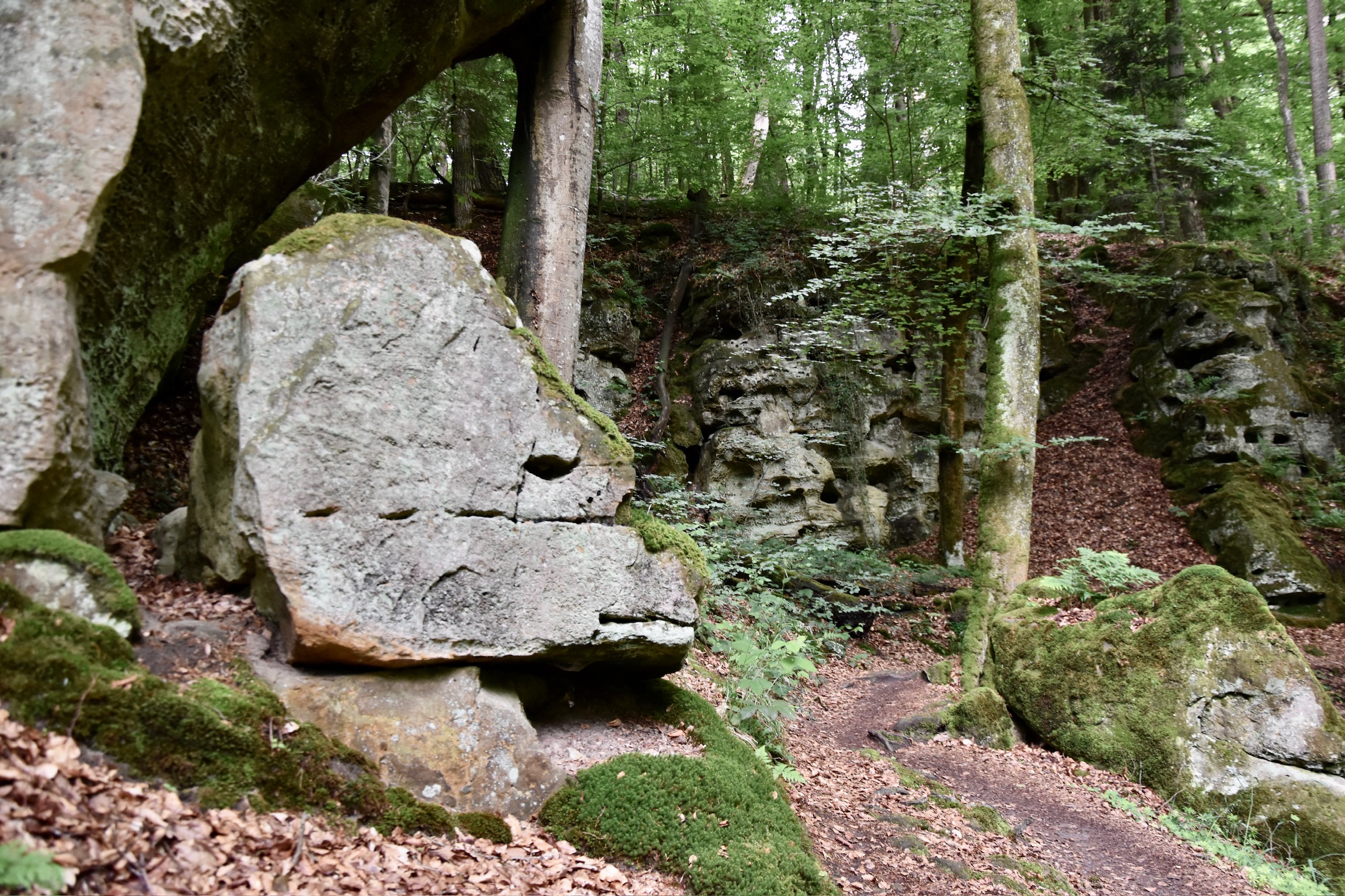
A large portion of this trail follows directly the route of the venerated Mullerthal Trail 2, quite possibly the best-known, most visited hiking route in the entire country. And yet this particular corner of it is almost always calm, as if the hiking tourists don’t venture too far away from the more famous sections of the trail around Echternach, Berdorf and Consdorf. Sure, this route may lack the photogenic drama of the Kuelscheier or Gorge de Loup, but the Scheidgen woods are every bit as pretty as (and probably a better representation of “typical” Mullerthal scenery than) just about anywhere else.
This is also – without question – the hiking trail that I have walked more often than any other in the country. Its quiet grandeur and serene beauty keep on calling me, and I make a point of going back every two or three years. On this occasion, I chose the anti-clockwise direction (an older iteration of this trail was clockwise-only; now you have the luxury of choice) and headed down into the woods towards Juckefeld.
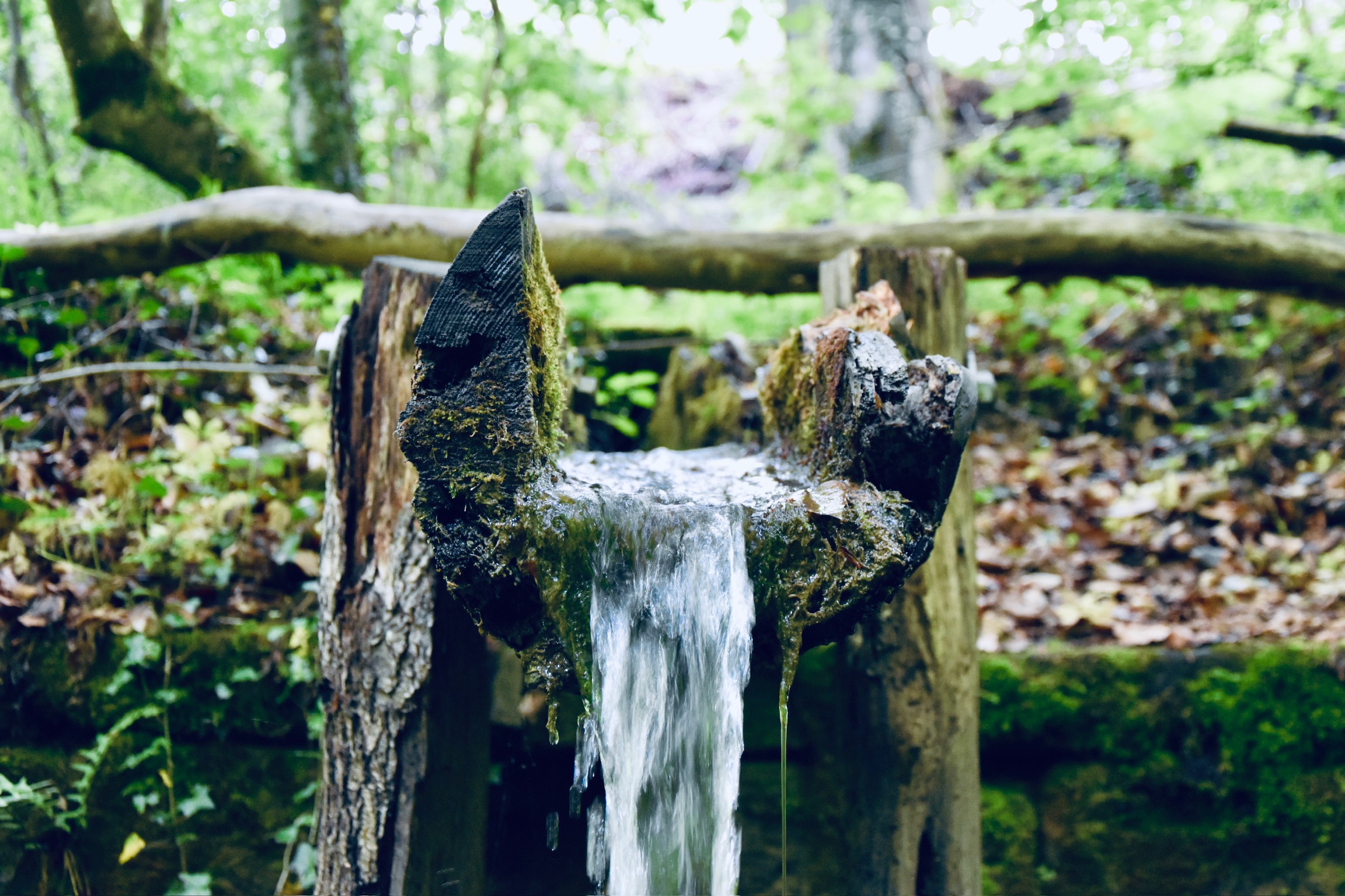
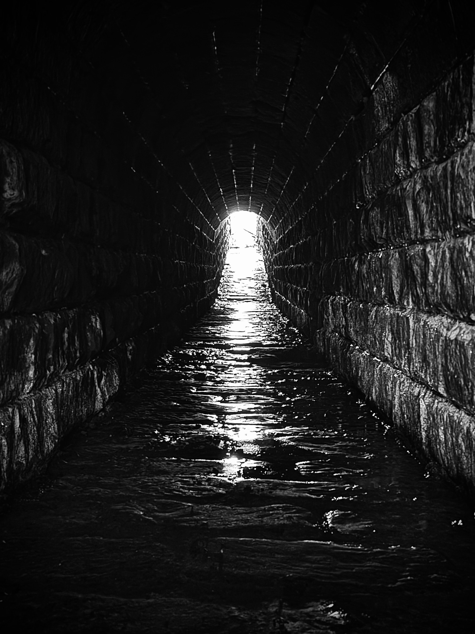
I’d seen it all before, but the camera still came out quickly and stayed out: an idyllic house in the green; an atmospheric tunnel under the cycle path; an old “Waschbur” of crystal-clear water; a rock that was surely once a dinosaur, frozen in stone since prehistoric times. (Or maybe I’ve just walked this trail too often…)

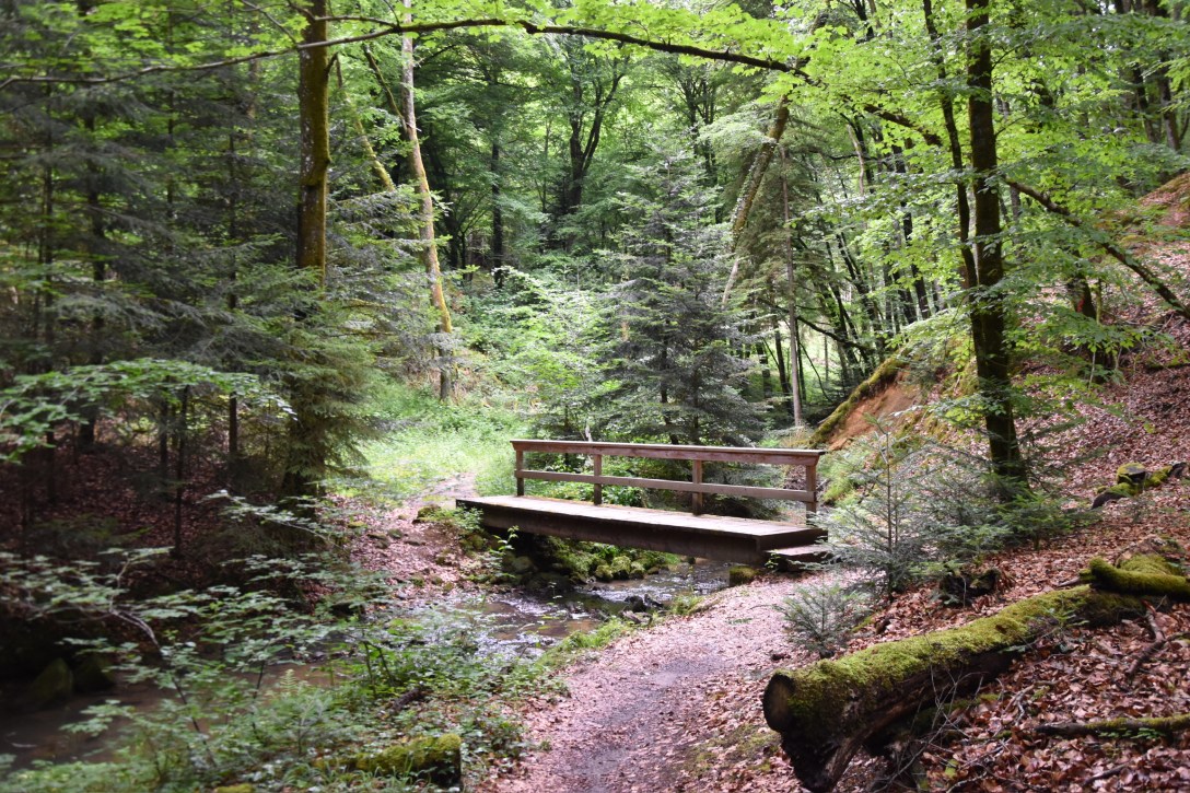
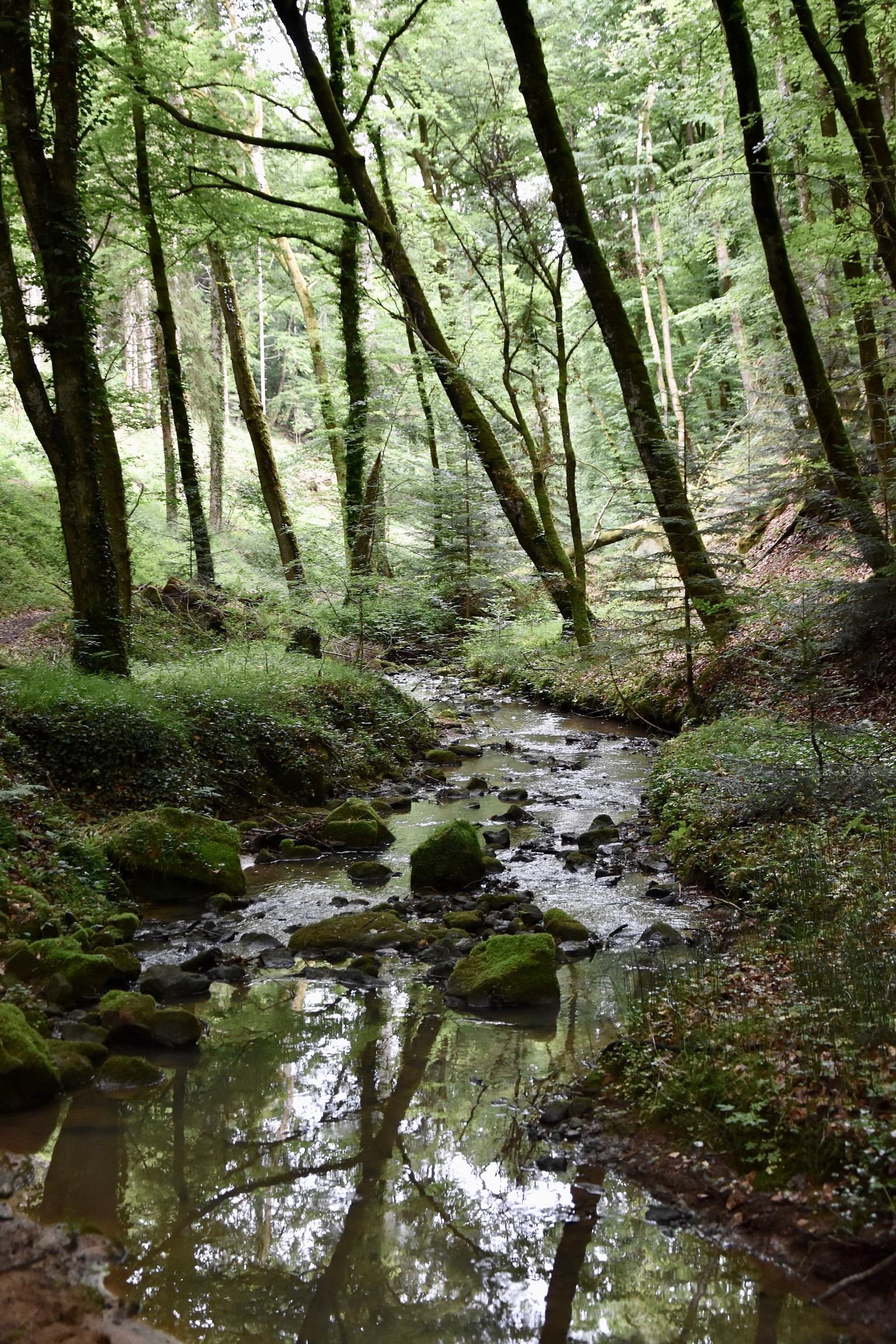
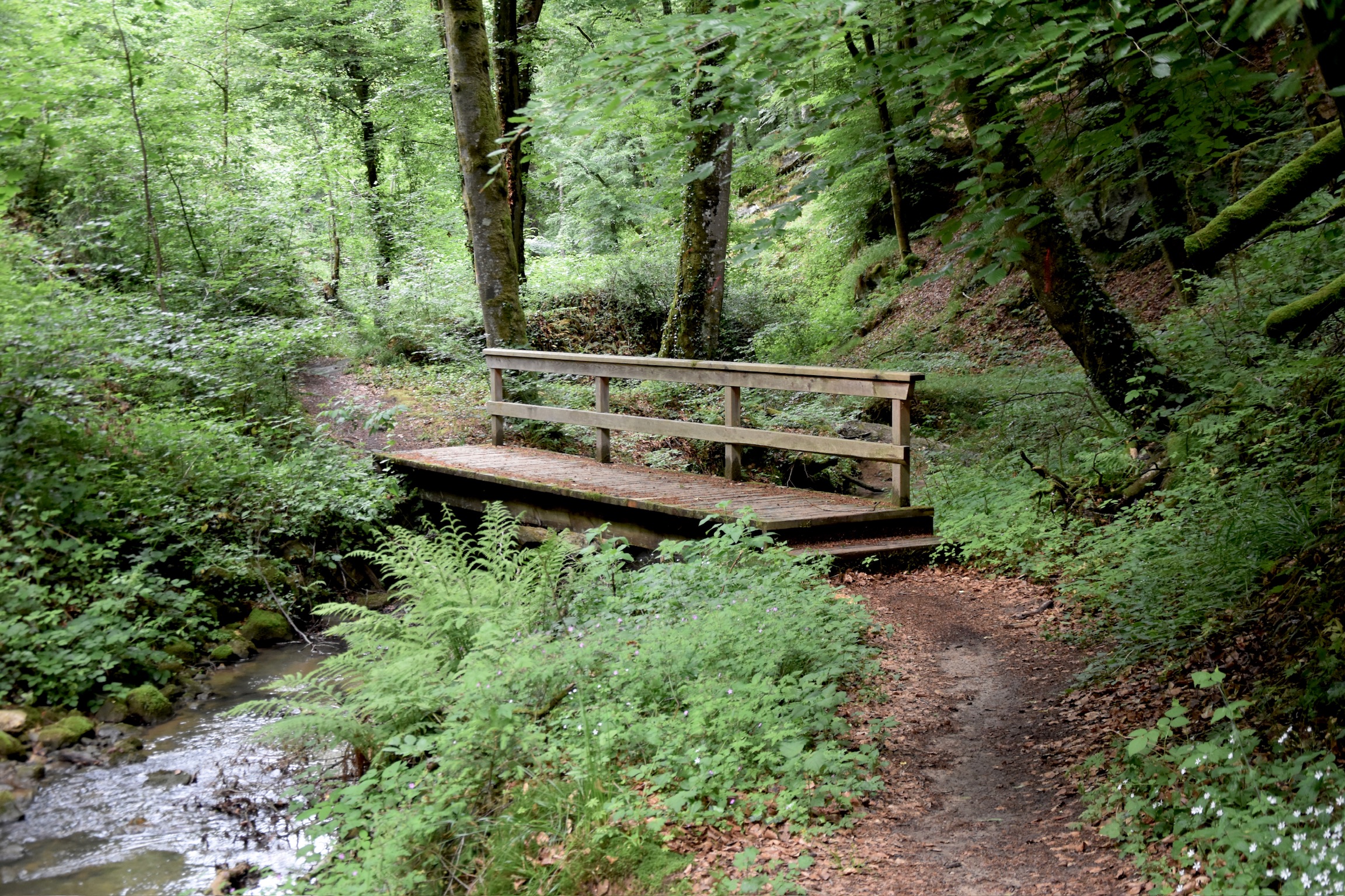
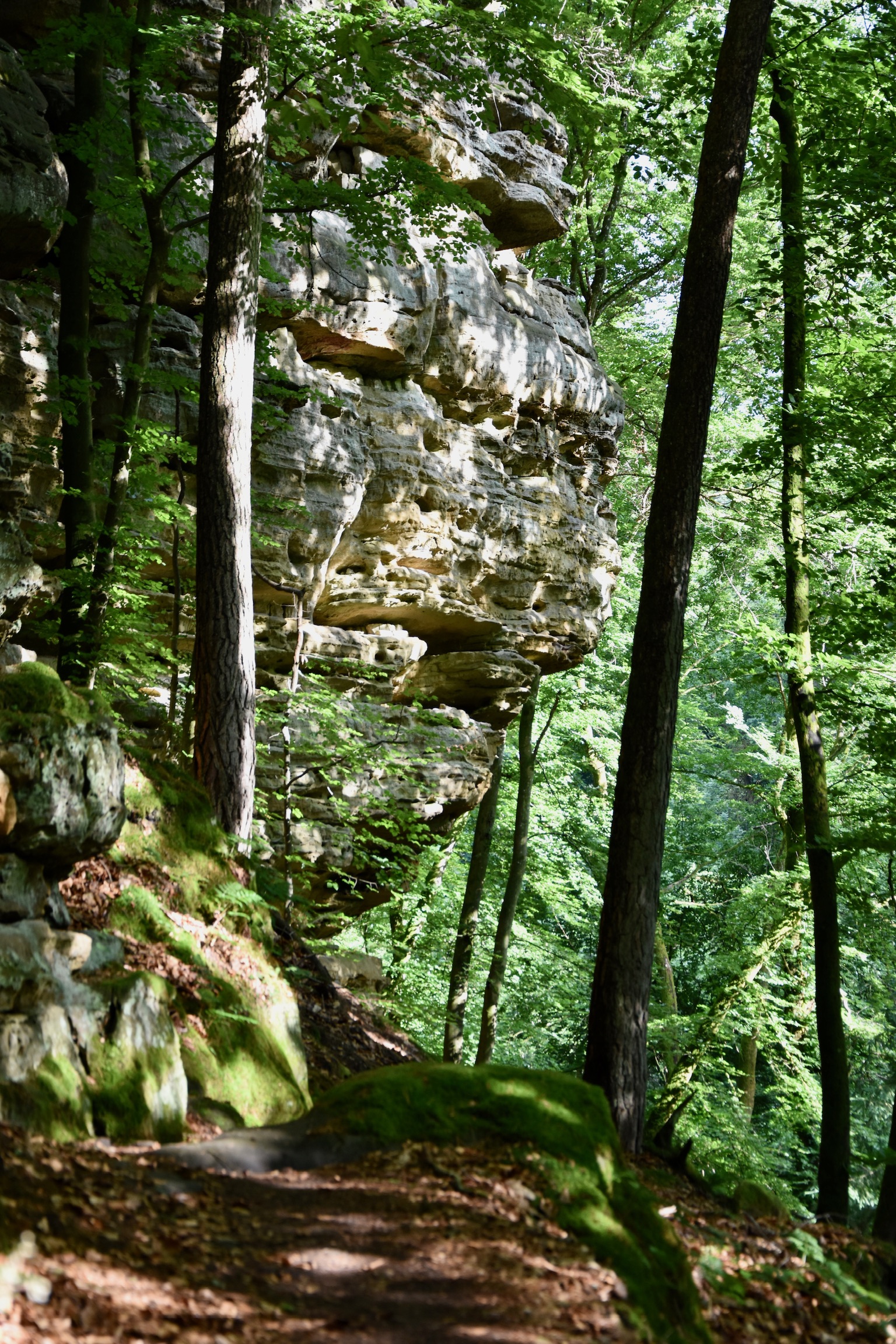
After the dino rock the valley turns a corner, and somehow manages to simultaneously widen out and deepen, the tops of the cliffs on either side barely visible through the lush green. The stream widens here too, and the hiker is carried over it by a succession of wooden bridges, each one prettier than the one before.
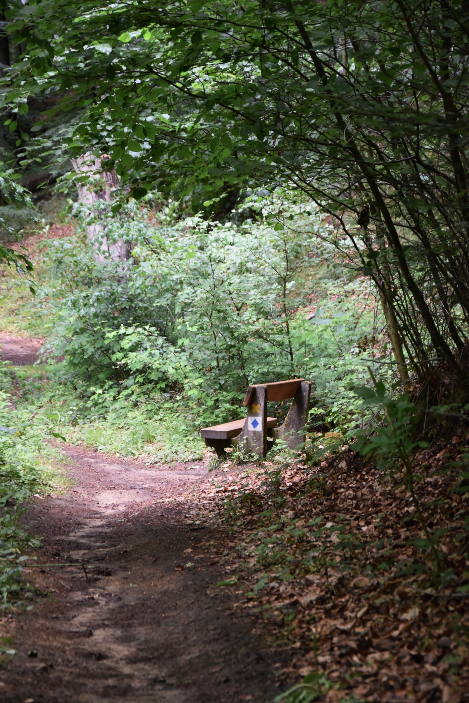
A glance at the route map shows the trail’s unusual shape: a bulge in the middle with two almost symmetrical 180° apex corners bookmarking either end. The first apex comes after the bridges, and passes through a rest area (two picnic tables) at the “Kalkesbach” railway station on the old “Charly” line between Luxembourg and Echternach.
The location of Kalkesbach station – with no villages for several kilometres in any direction – may seem oddly remote today, but it once served forestry workers and nearby sandstone quarries. It’s a lovely reminder that back then, this forest was buzzing with industry – and the stop was a lifeline for transporting both people and stone.


After the station, the path rises up into the rocks, passing an “Einsiedelei” (hermitage, one of two on this short trail) before wobbling down to the cycle path again, then steeply up over mossy steps until, finally, for the first and only brief time during the trail, out of the forest. It’s only an interlude (and the least interesting section of the hike) but it serves as a nice breather as we approach the grand finale of the Auto-Pédestre Scheidgen – a journey through the Ponteschgronn valley.


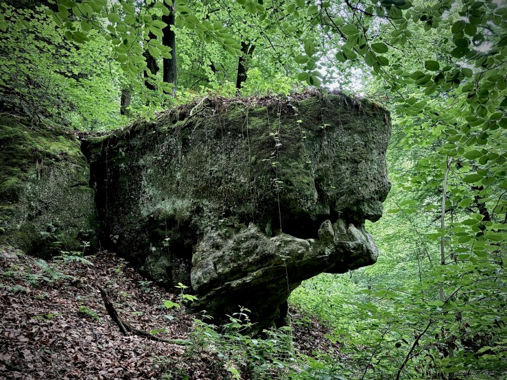
Here’s the sad truth: my photos will never do justice to this sacred corner of the Mullerthal. The camera sees chaos – ivy, moss, rocks, ferns – and doesn’t know what to do with it all. But we humans see differently. One of the deep mysteries of being human is that we can process a visual and sensory feast like the Ponteschgronn valley and somehow savour the sheer beauty of it all.
We can feel gratitude, from the depths of our hearts, that the world – despite all its ugliness – can be this beautiful. We can filter out the visual noise and focus on little things in our field of view that bring us joy: a rock that inexplicably looks like a head, a towering overhang, an old green bench plonked improbably at the foot of a sandstone behemoth, a weather-beaten moss-covered sign pointing to nothing in particular. We can breathe in the earthy aroma, we can smile at the choruses of birdsong and the rhythmic crunch of our boots on the path, we can feel the grainy texture of the millennia-old rocks.
In essence, the Ponteschgrunn is a place where we can feel alive, where we can feel human, where we can feel at one with this beautiful and crazy world that we live in.
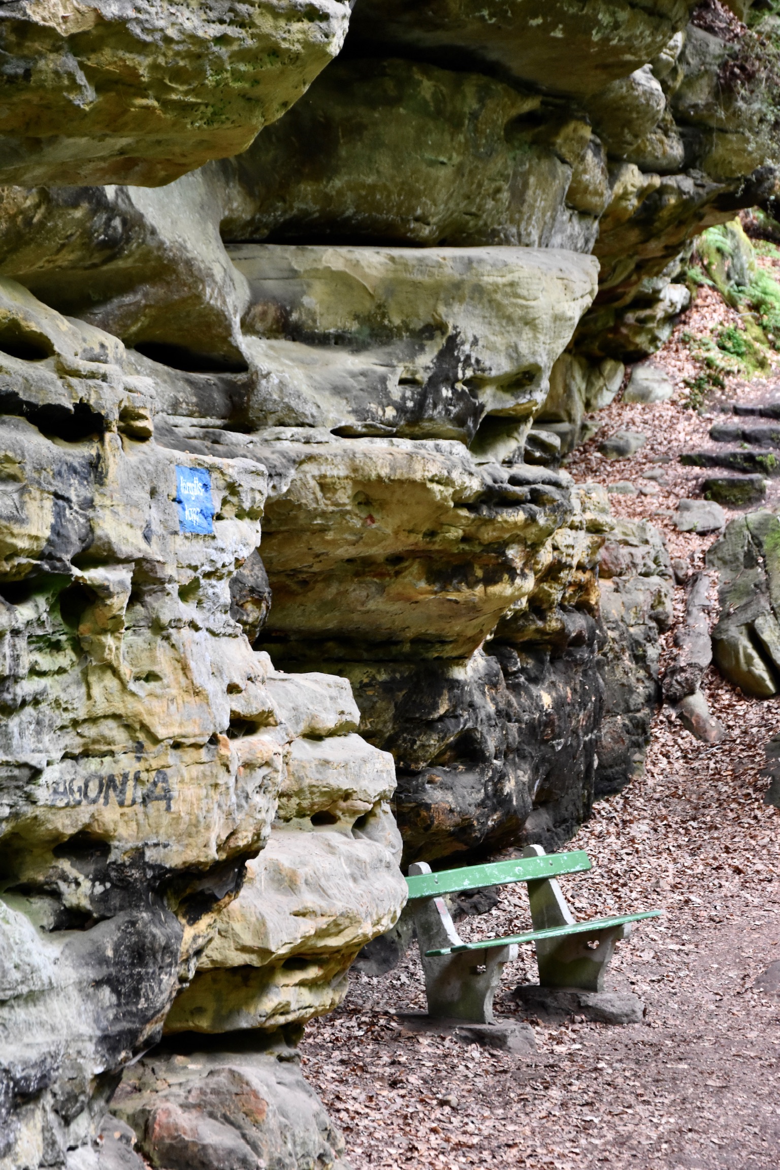

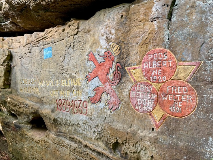
Near the end of this section is where you’ll find the second “Einsiedelei” of the day (note: the actual hiding spot of the hermit is half-way up the cliff; very difficult to access from the bottom, very hard to find from the top. He chose well.) This one doubles as a monument to three young men who I have been (sort of…) reliably informed were members of the Luxembourg resistance during the Second World War (can anyone confirm?).
One of the three – Fred Welter – later worked at the Ministry of Tourism and played a key role in creating Luxembourg’s national hiking network. Today, a 21km trail bearing his name loops between Berdorf, Consdorf and Scheidgen. It rivals anything the Mullerthal Trail has to offer—though sadly it receives neither the marketing nor the maintenance it truly deserves.
As this show of sandstone and sensations draws to a close, the path rises and turns abruptly on its second apex. After the drama of the bottom of the Ponteschgronn valley, the Auto-Pédestre Scheidgen now takes you somewhere the Mullerthal Trail does not: the top.
Things are calmer up here: the trees seem straighter and the ferns are bushier. Wild blueberries and – in spring – fields of white wood anemones line the slow and winding path back to the starting point. It’s a perfect time to put the camera away, a chance to reflect on everything that’s quietly wonderful about simply putting one foot in front of the other through the Luxembourg woods.
Notes and useful links
*Official sources list this trail as being 7.5km-8km. I have measured it several times and have always come up with a significantly higher figure. Even adjusting for GPS inaccuracies, 9km feels more realistic.
- Official trail website
- Our track on Komoot
- Hotel / restaurant at start / finish.
All photos and text (c) 2025 Jonathan Orr
