
- 12km – Intermediate – 3 to 4 hours.
- Combines Beaufort’s must-see attractions with stretches of blissful woodland solitude.
- Park and start directly at the Château de Beaufort.
- By bus: closest stop is Beaufort Op der Gare, then a 10 minutes walk down to the castle.
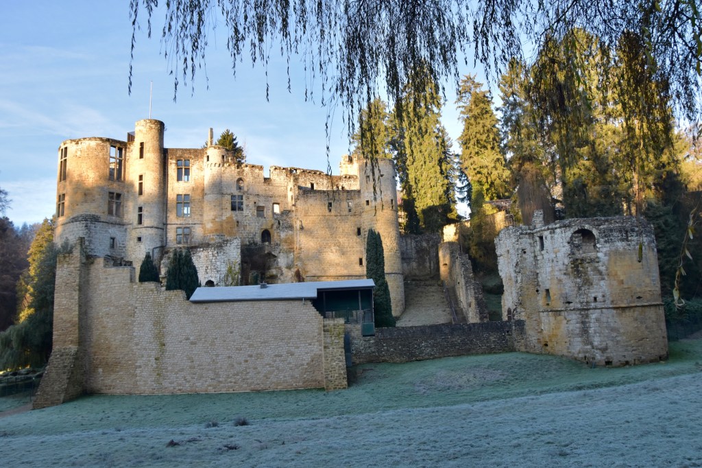
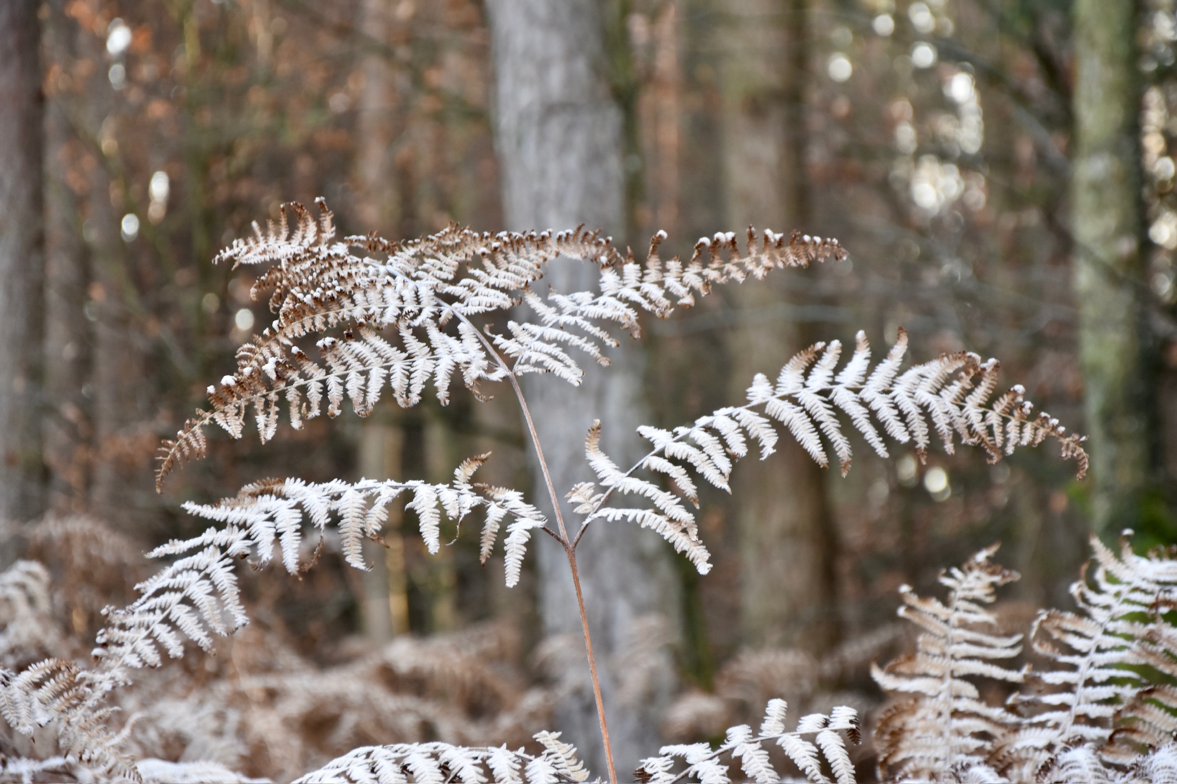
Beaufort’s medieval castle greeted me in a vision of steel: cold stone walls under a hard crackle of frost. The calendar insisted it was still autumn, but at -6°C the morning felt emphatically like winter. The air was perfectly still.
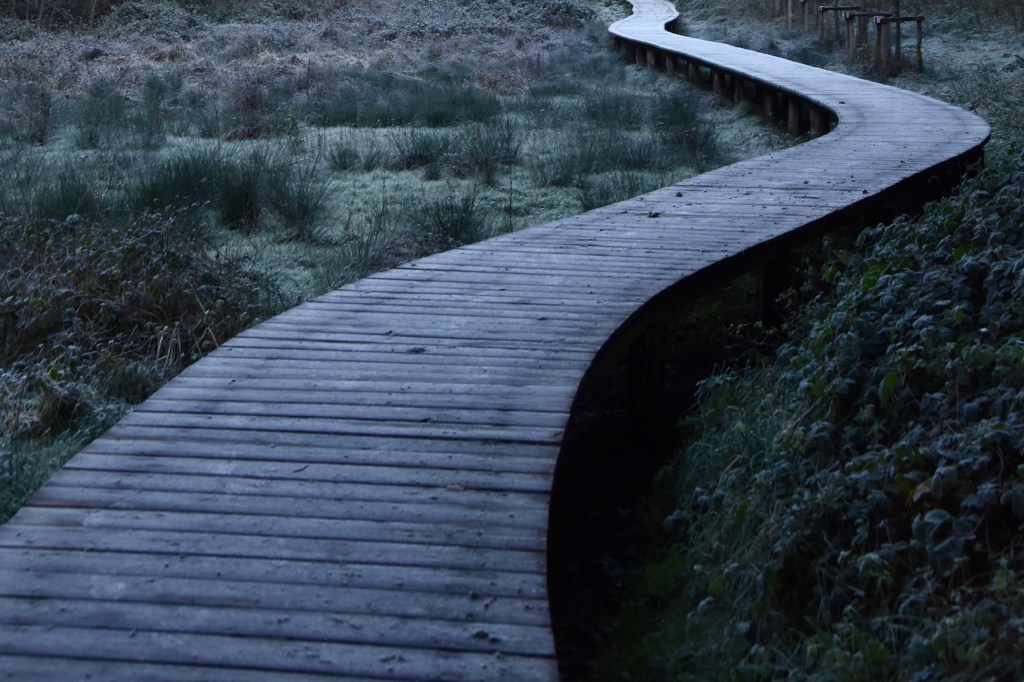
Leaving the castle behind, I stepped over frozen ground, slipped through a clump of trees and crossed a hoarfrost-coated boardwalk into the deeper woods for one of my absolute favourite Mullerthal hikes, the Beaufort B7.
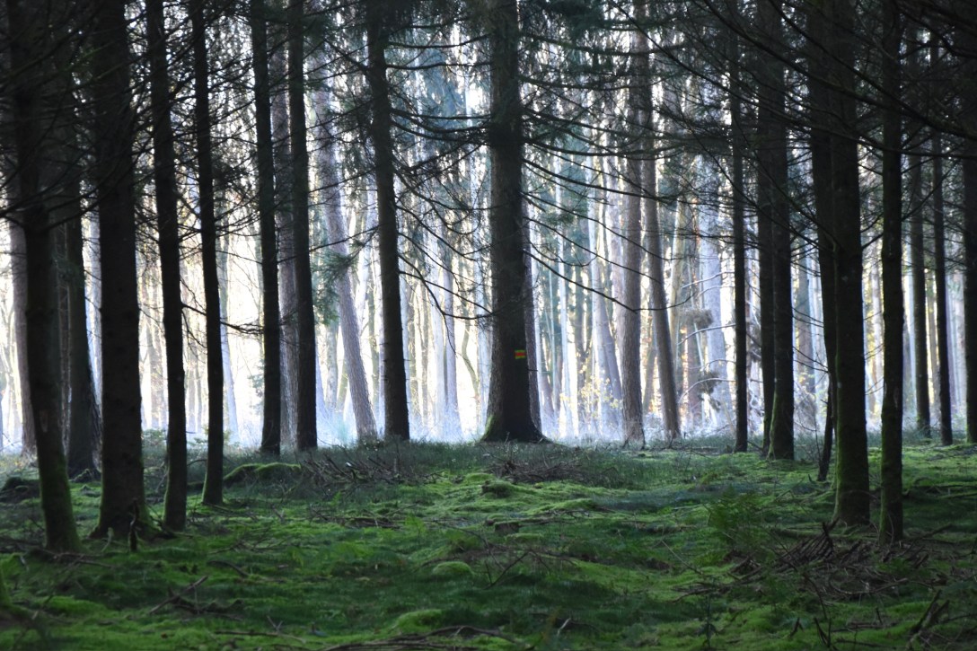
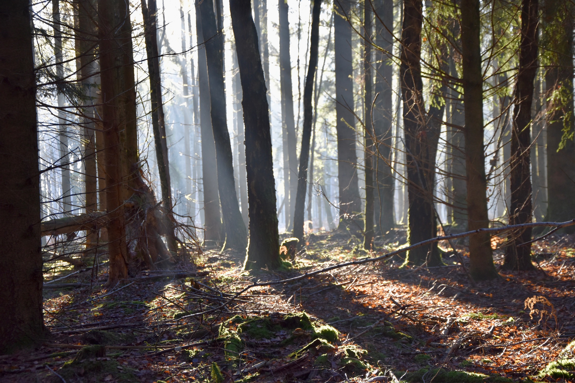
The Beaufort B7 trail is, for me, the perfect blend of sightseeing and forest bathing. If you want that classic Instagram moment, you’ll find it here: sweeping castle perspectives, a pretty rock chapel and what is arguably one of the most beautiful streams in Luxembourg. But if you crave kilometre after kilometre of solitude, quiet woodland and space to let your thoughts settle, you will get that too. Once the castle drops from view you pass a water playground, a forest lake… and then almost nothing but trees as the path follows Mullerthal Trail 3 up towards Berens and onwards through deep, silent woodland.
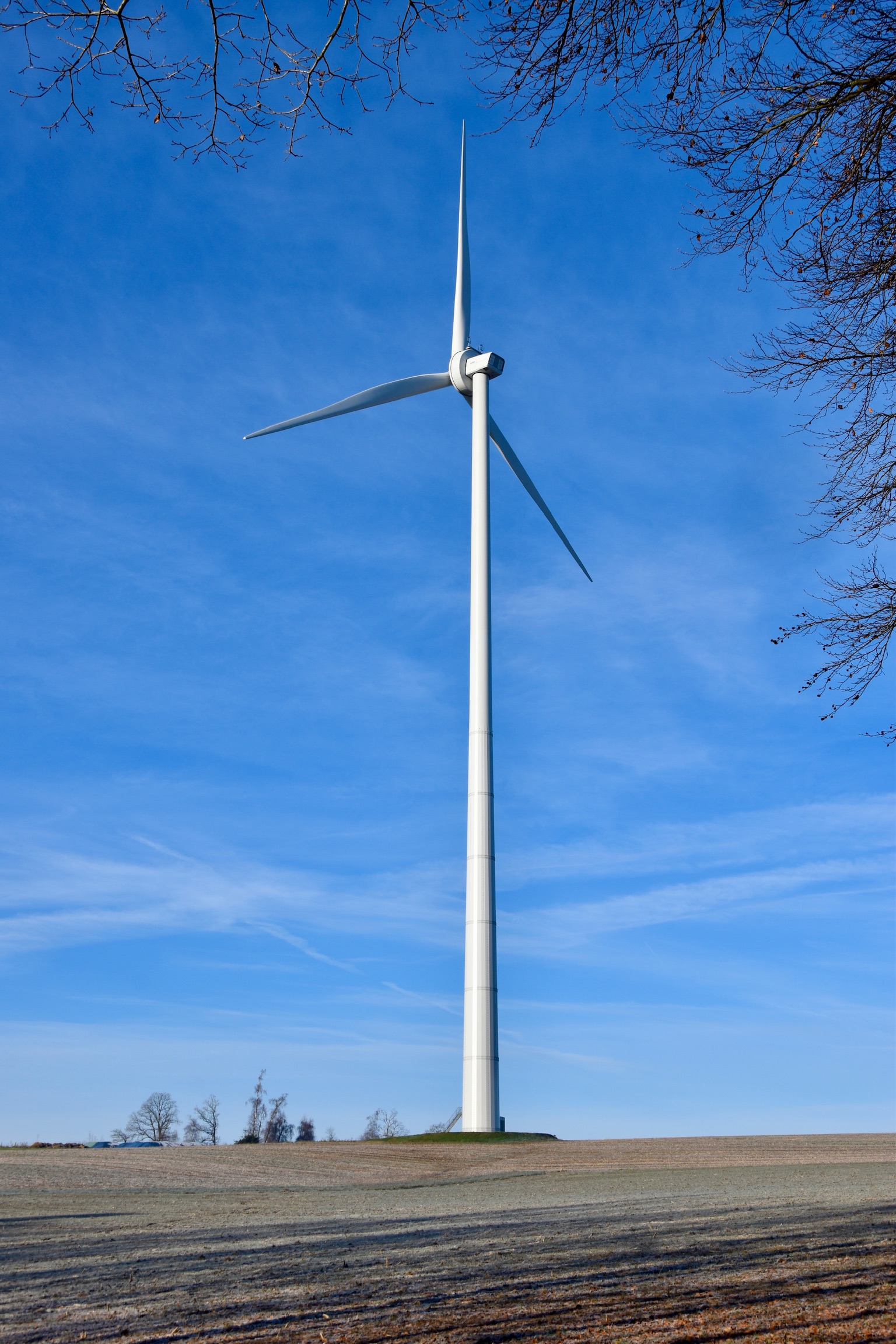
Eventually the trees open out into rolling farmland. Up on this plateau the B7 skirts the base of the Aerenzdall wind farm. I was struck again by how immense these structures are; some modern Luxembourg turbines reach over 200 metres from base to blade tip, making them among the tallest freestanding structures in the country, and considerably higher than the newly-crowned tallest church in the world, the Sagrada Familia in Barcelona.

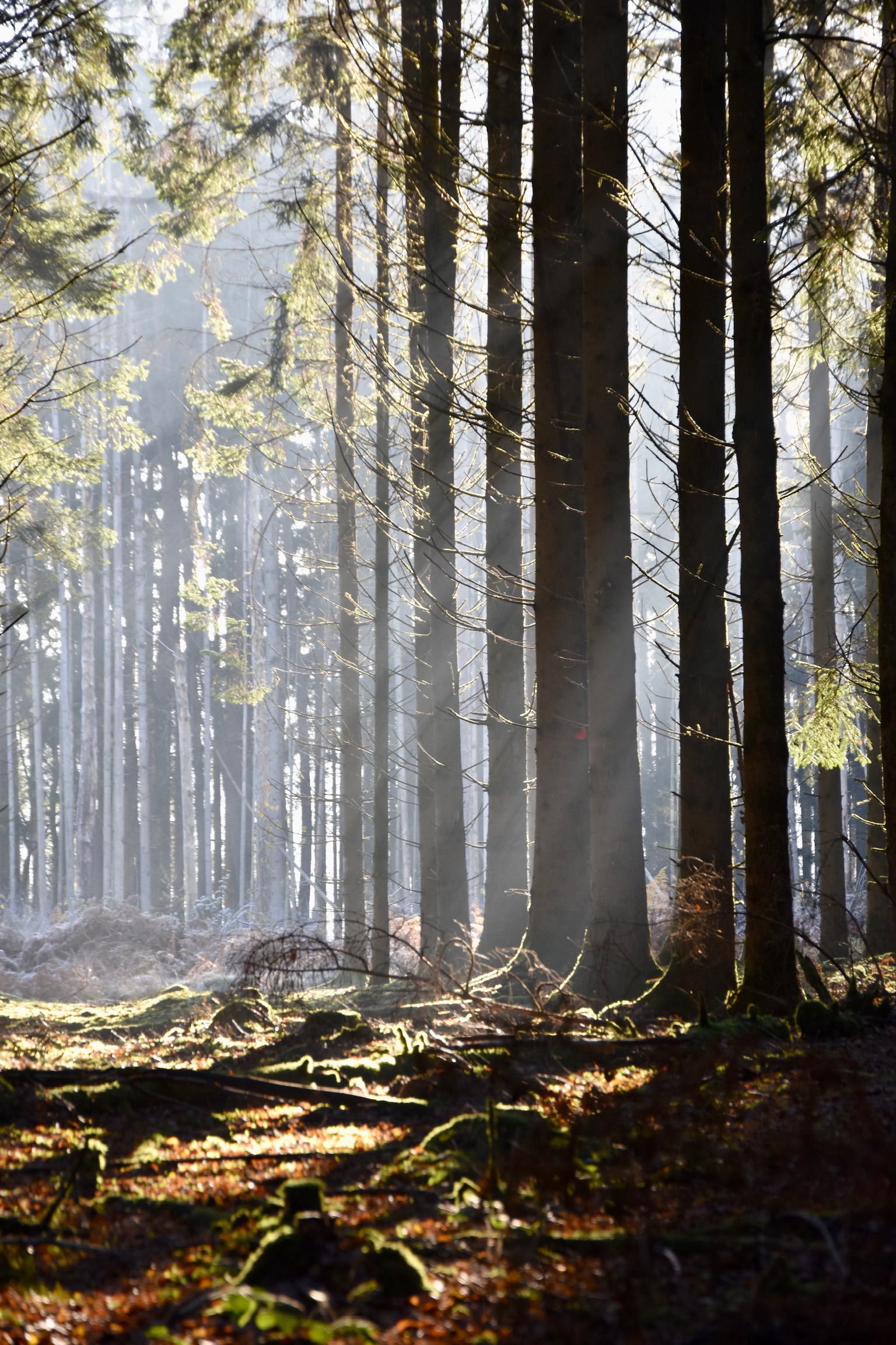
With the soft whoosh of the turbines fading behind you, the trail enters its least exciting section, a simple march past a disused farm and briefly onto a quiet country road before looping sharply downhill towards the woods. It isn’t the highlight of the hike, but the reward comes later: from here until the end you remain in forest, and for several kilometres you walk entirely on the B7’s own track. In practice, this means you will rarely meet another person. The Mullerthal woods, normally so popular, become your own private world for a while.
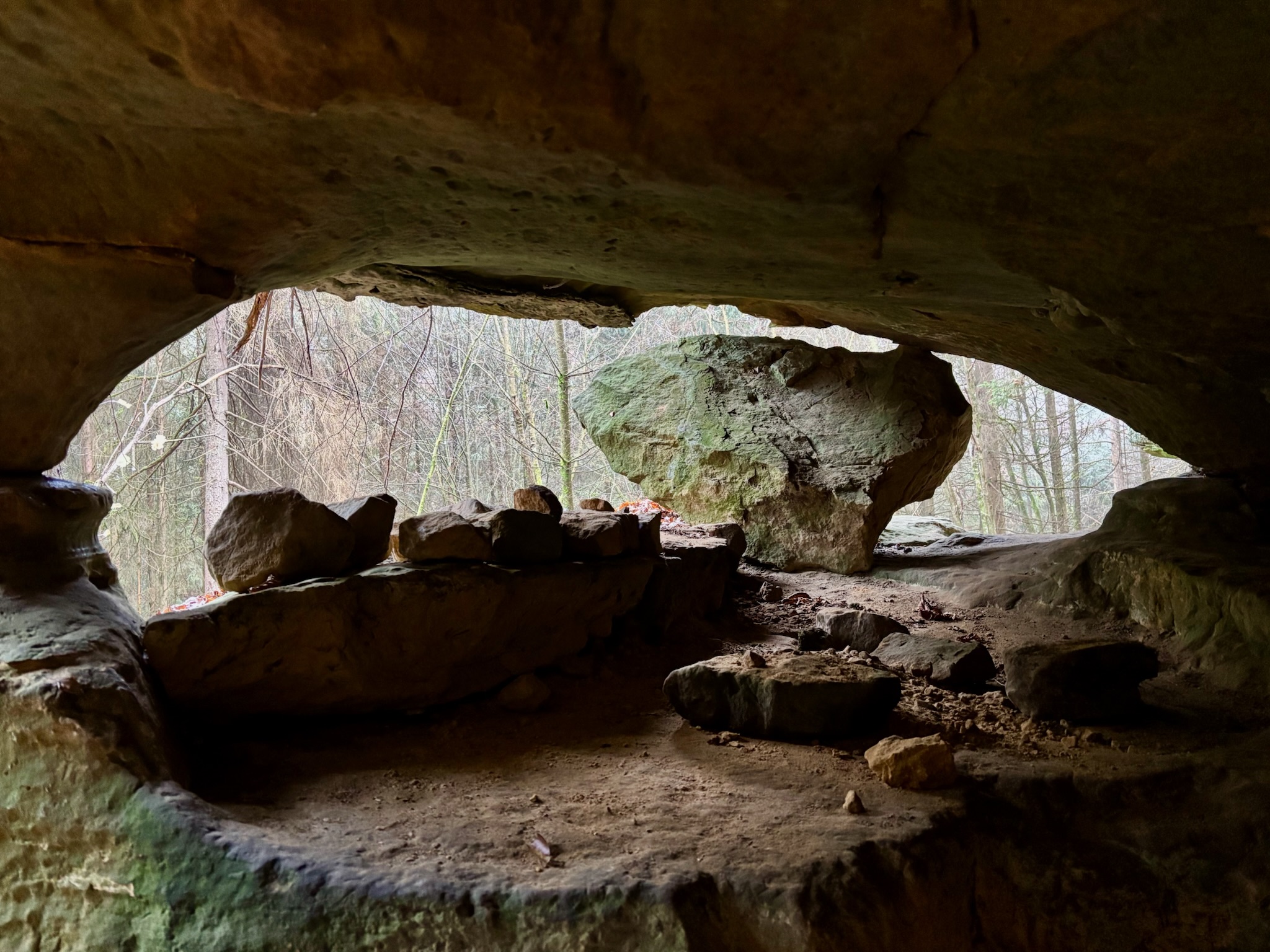
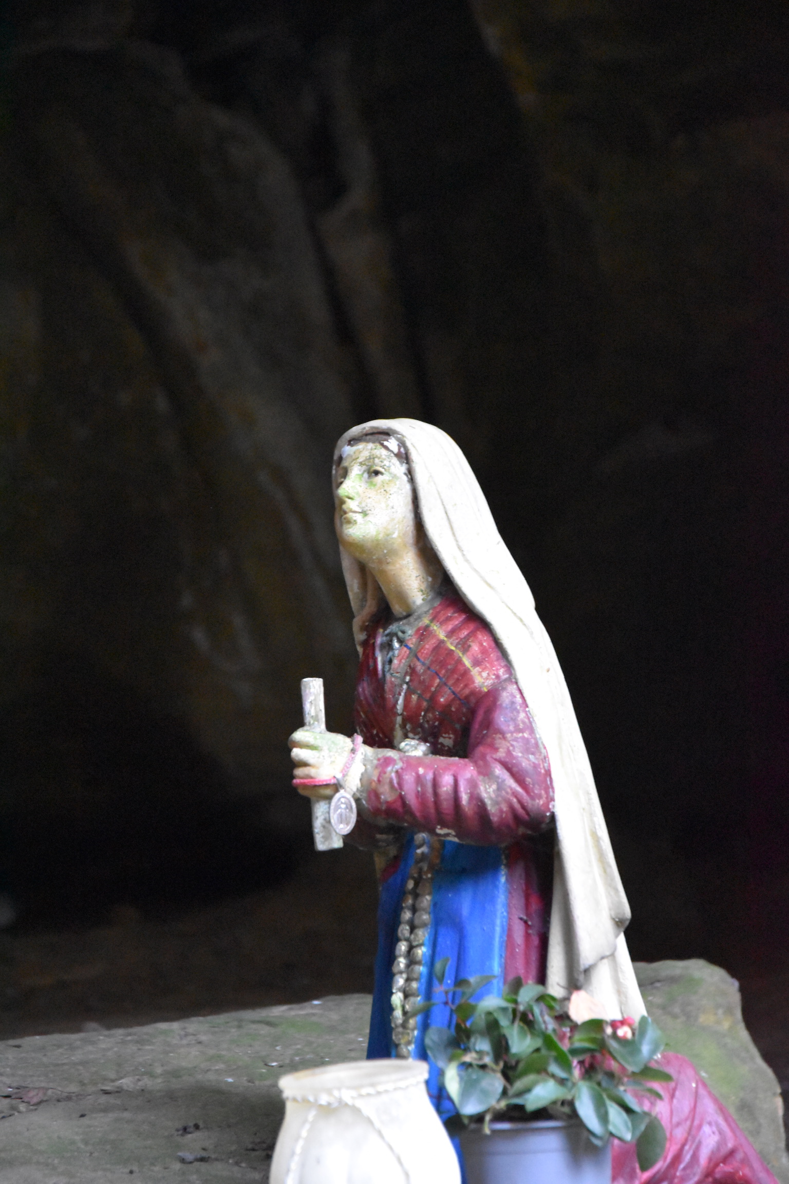
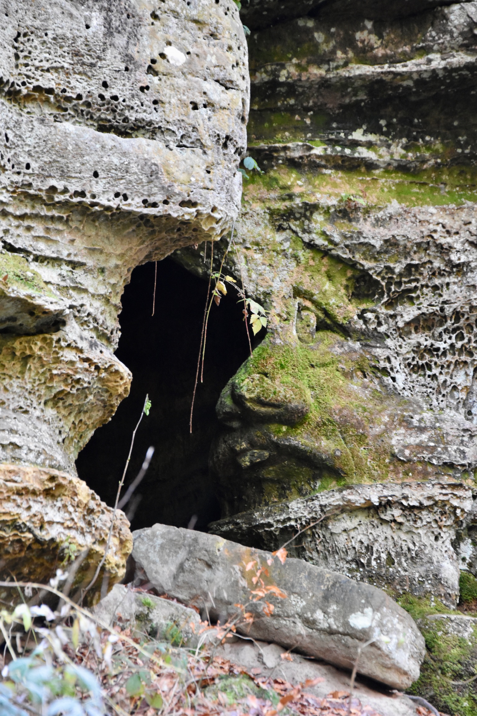
A forest chapel comes into view on your right-hand side, with hand-written information boards (in Luxembourgish only) explaining that this was a hiding place for local resistance fighters during WWII. There are benches here, too, making it a perfect spot for a quick break before the last leg of the hike.

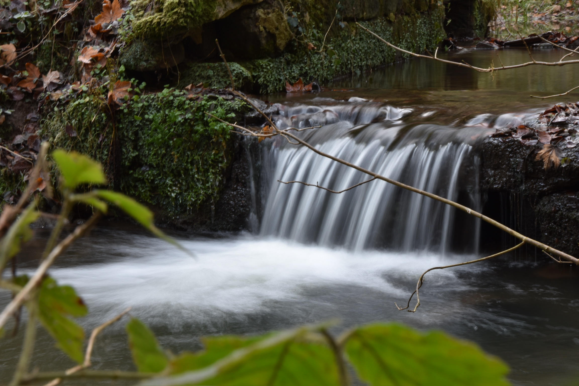
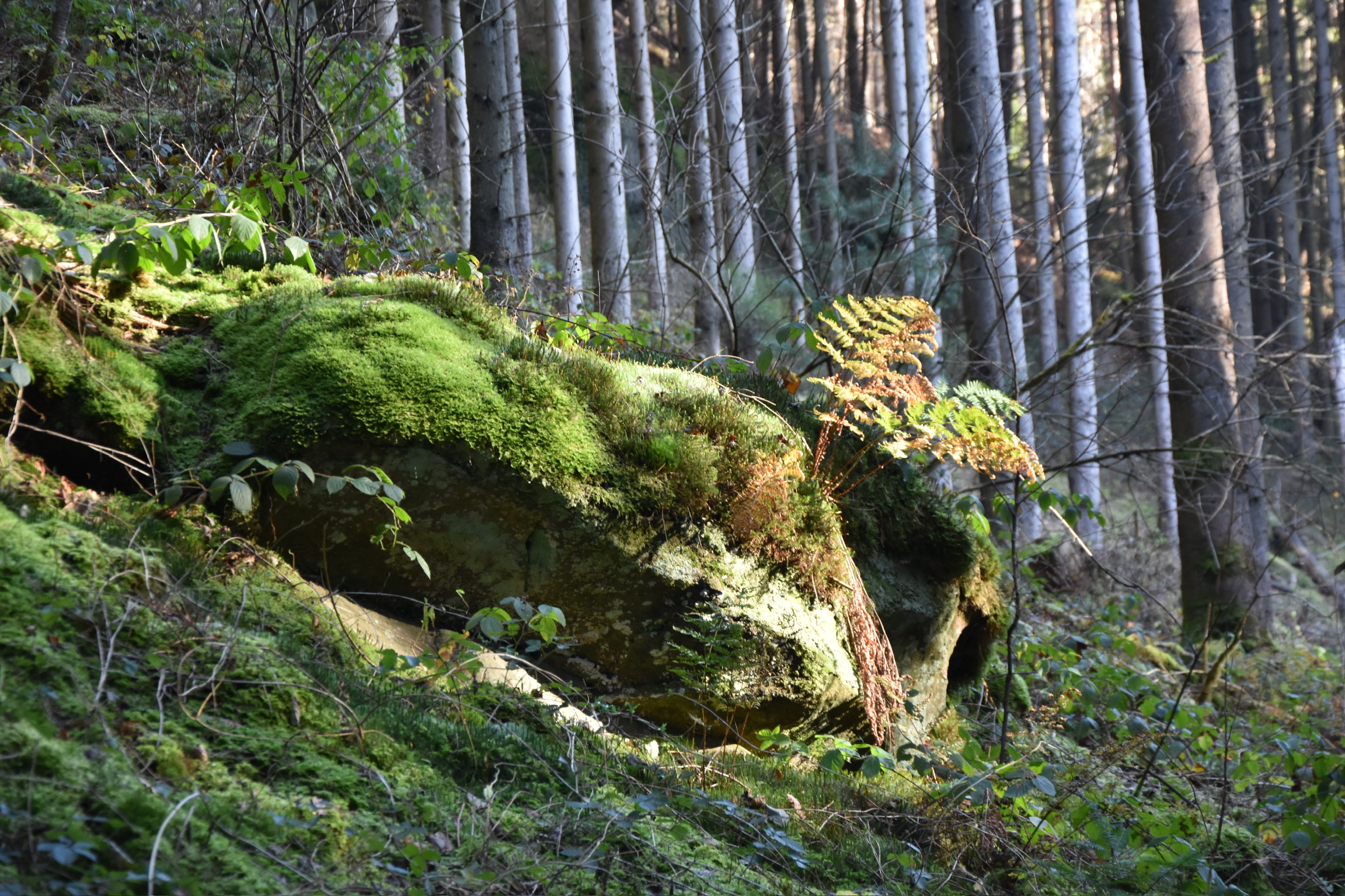
The Haupeschbaach and Hallerbaach valleys are famed as two of Luxembourg’s prettiest places, and I have written about them many times before. After the chapel, the B7 follows a quieter fold of the Hallerbaach valley, with steep sides, tumbled mossy boulders and a stream that murmurs constantly through the trees. Small waterfalls appear for those who pause long enough to notice them.
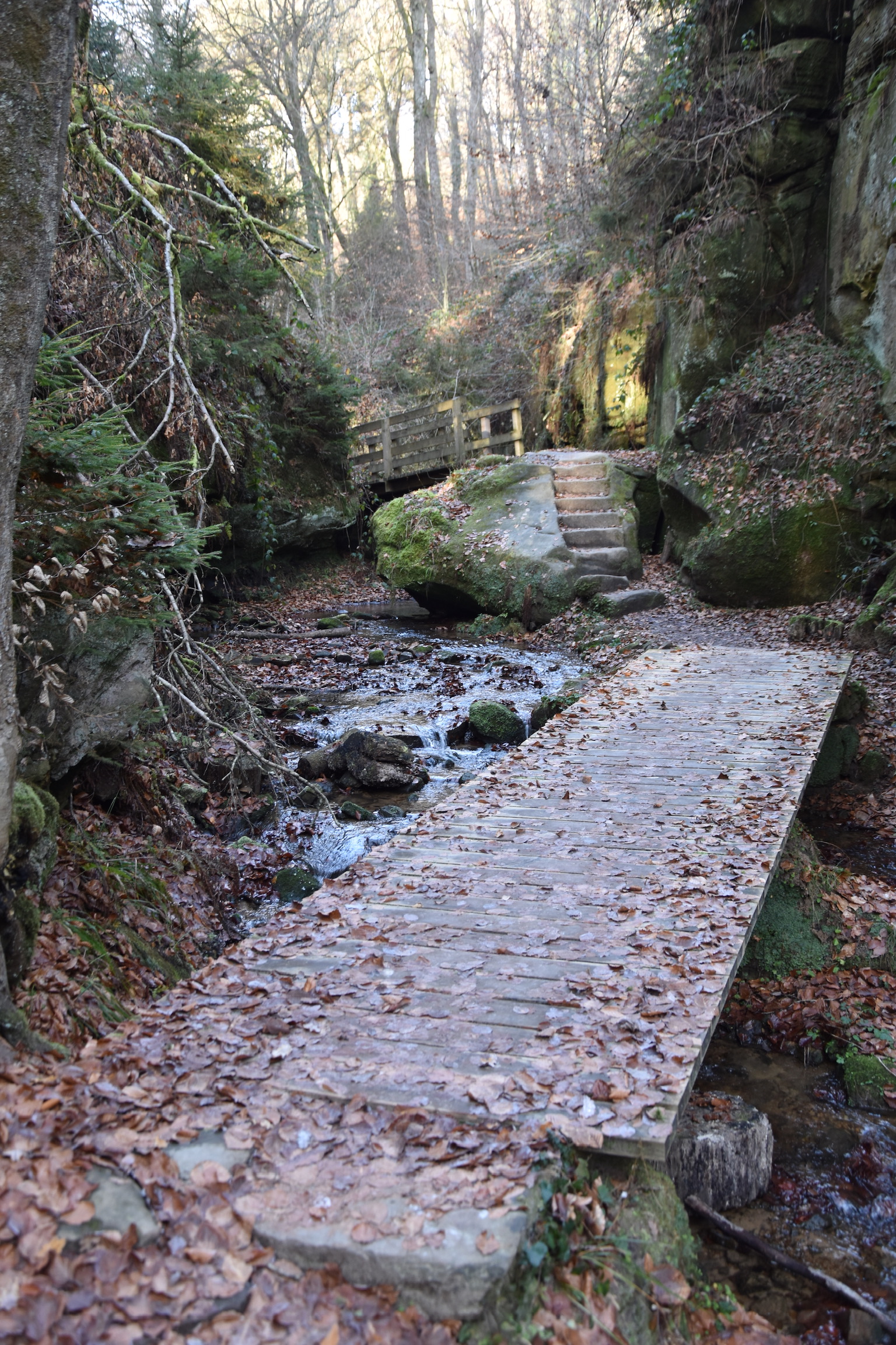
A left turn one kilometre after Hallermillen brings you onto the grand finale: the Haupeschbaach. Compared to the Hallerbaach, this valley feels wilder, more elemental. The footpath begins sensibly enough but soon finds itself in a playful tussle with the stream, swapping roles and occasionally disappearing into shallow water. Waterproof boots and decent balance are very helpful here, especially after rain.

Gradually the valley calms as you climb, and then the end reveals itself: Beaufort Castles reflected perfectly in the still surface of their lake. It is a deeply satisfying conclusion to what is already a wonderfully varied and contemplative walk, a trail that mixes solitude with scenery, peacefulness with photography, and gives you plenty of space to breathe and simply enjoy the magnificence of the Mullerthal.


All photos and text (c) 2025 Jonathan Orr
Similar hikes in the Beaufort area:
- B1 Beaufort – 10km – One of the best hikes in Luxembourg, no question.
- Geotrail Beaufort – 5km – A family-friendly trail showcasing the Hallerbaach and Haupeschbaach, with multilingual information boards along the way.
- W4 Haller – 7km – A quieter, more varied trail. A short diversion takes you to the WWII chapel on the B7.
