
- 4.5km – Easy / medium (but quite some ups and downs) .
- Allow at least 2 hours, more if you wish to explore the museums.
- Along with the Circuit Wenzel, one of the must-do hikes for any visitor to Luxembourg City.
- Explore impressive “Vauban” fortifications and savour spectacular views over the Alzette Valley and the old town.
- By bus: Pfaffenthal / Um Bock. Currently served by buses 9, 14 & 15. (But, really, any city centre bus stop will do.)
- Alternative: Tram to Philharmonie / MUDAM, then pick up the trail near the museums.
Visitors to Luxembourg who wish to discover this fascinating city on foot should probably start with the Circuit Wenzel. But if they are still hungry for picture-perfect viewpoints and want to get closer to the city’s trademark Vauban fortifications, the Vauban Circular Walk should be next on their list.
In many ways, the Vauban trail is actually better than Wenzel. Signposting is clearer, the crowds are thinner, and there is a greater sense of adventure and discovery, particularly around the Fort Niedergrünewald / Parc Dräi Eechelen. Whilst Wenzel gives you the classic Insta-worthy viewpoints over the old town, Vauban offers a deeper appreciation of how this city was engineered to look the way it does today. It shows, in other words, that Luxembourg was built to be defended.
And, oh my word, has military architecture never been so beautiful…
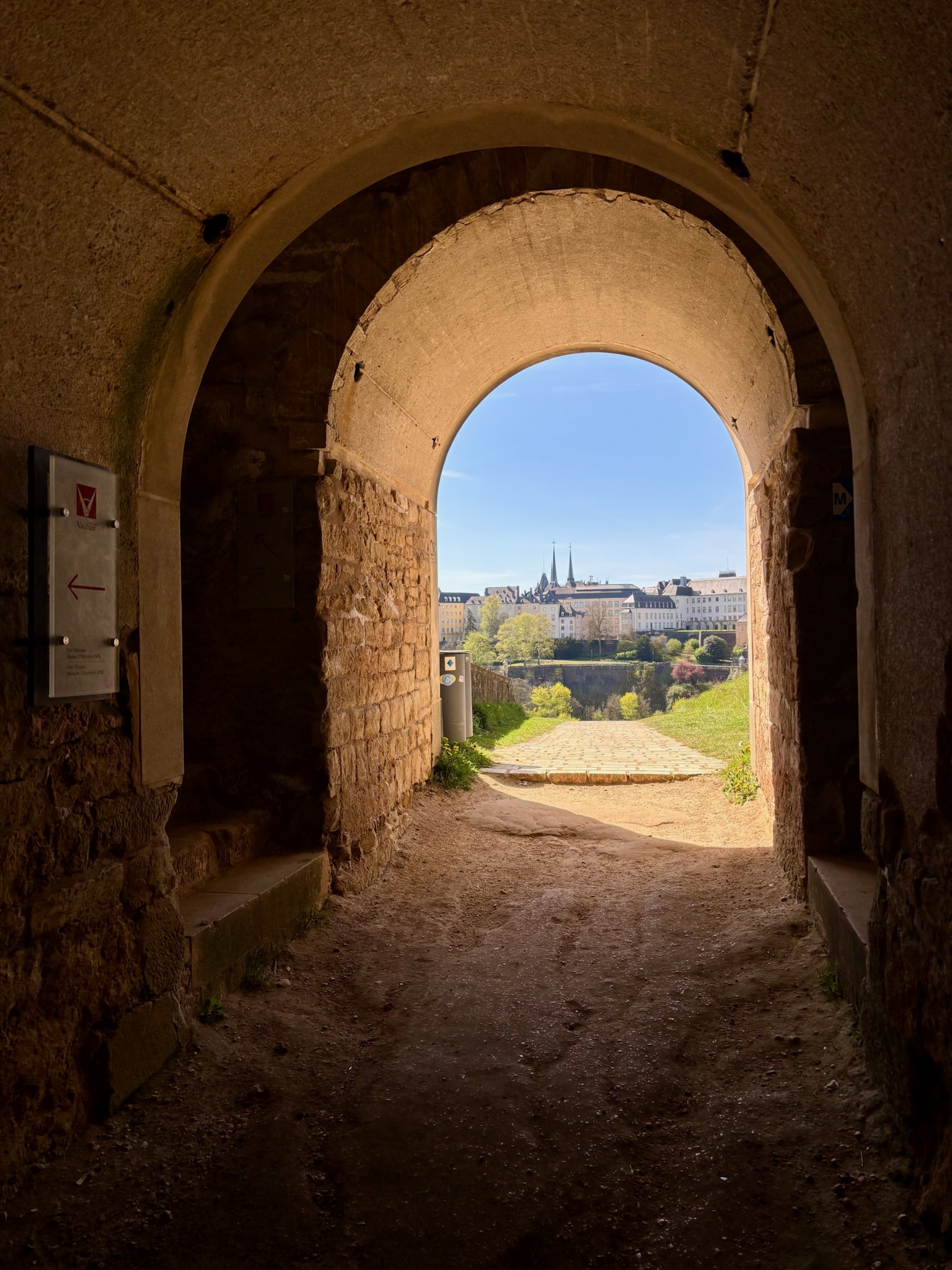
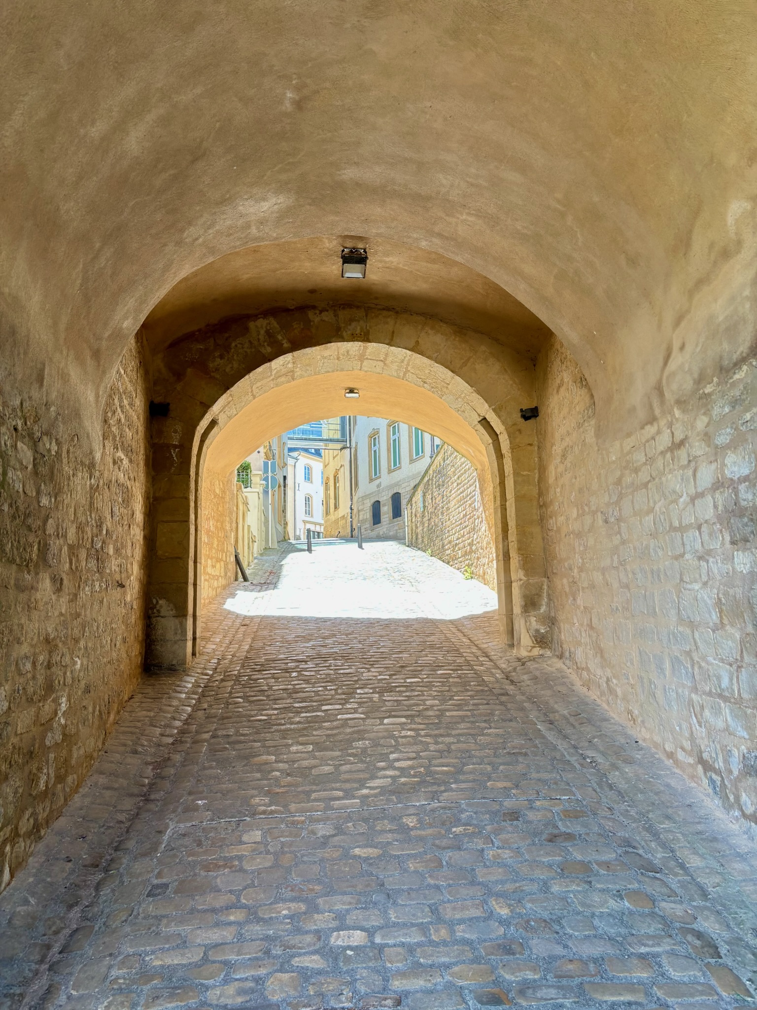
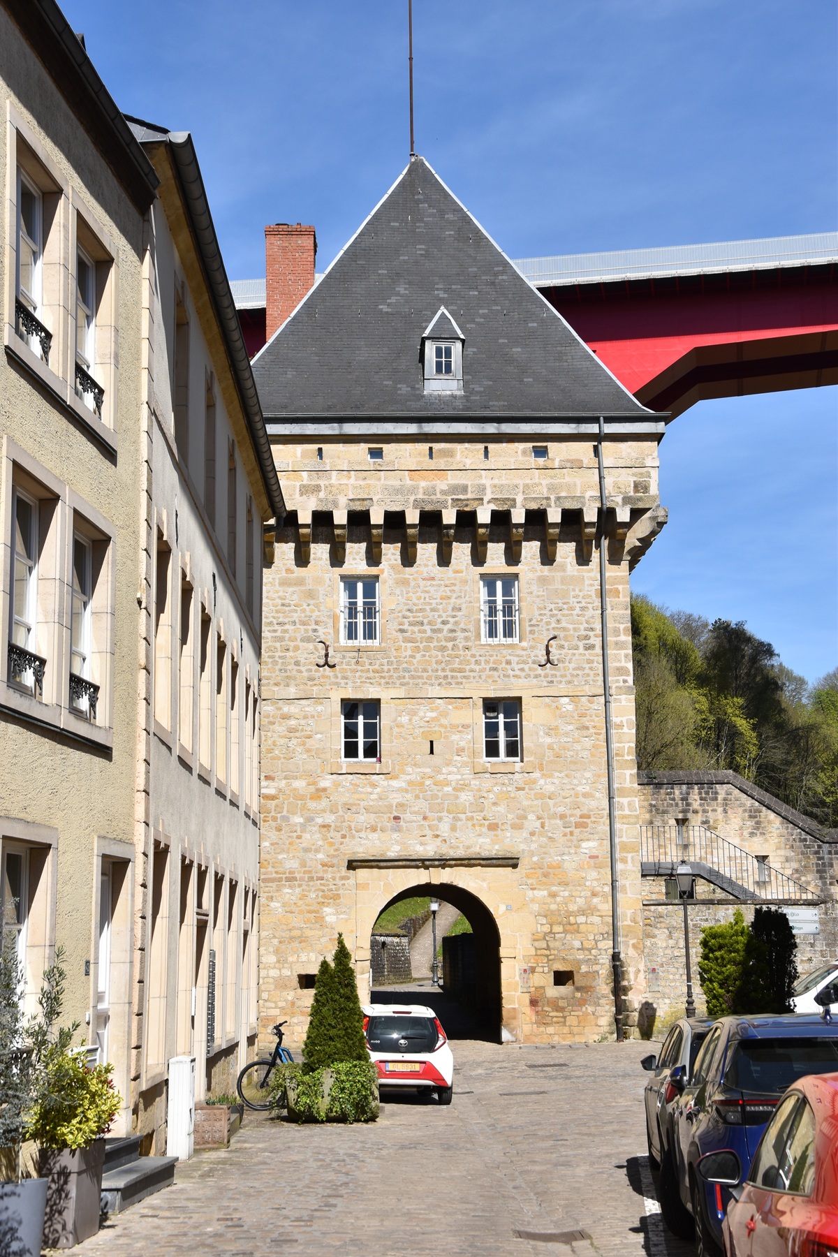
The trail starts directly on the Bock, where Luxembourg’s buzzing city centre abruptly gives way to the verdant depths of the Alzette valley. Picking up your first signpost soon takes you through the thick stone archway of an ancient city gatehouse towards your first Spanish towers of the day: one standing sentinel over the valley and another looming high above you as you descend.
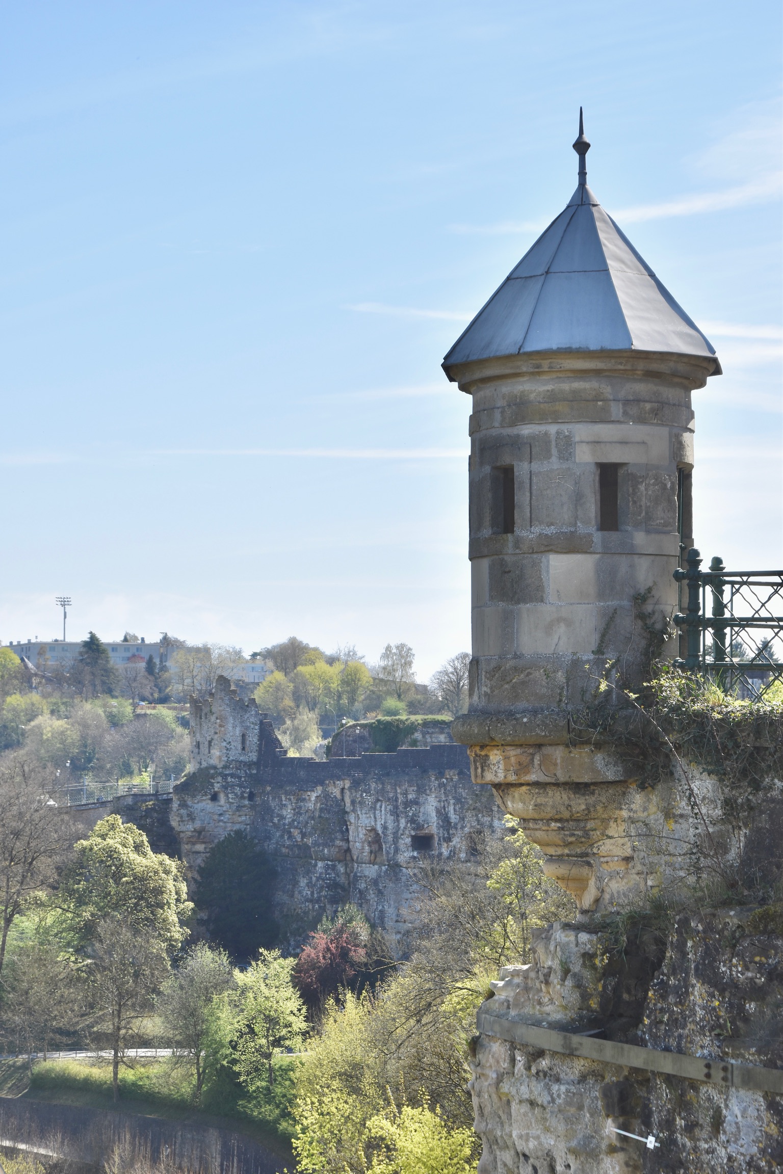
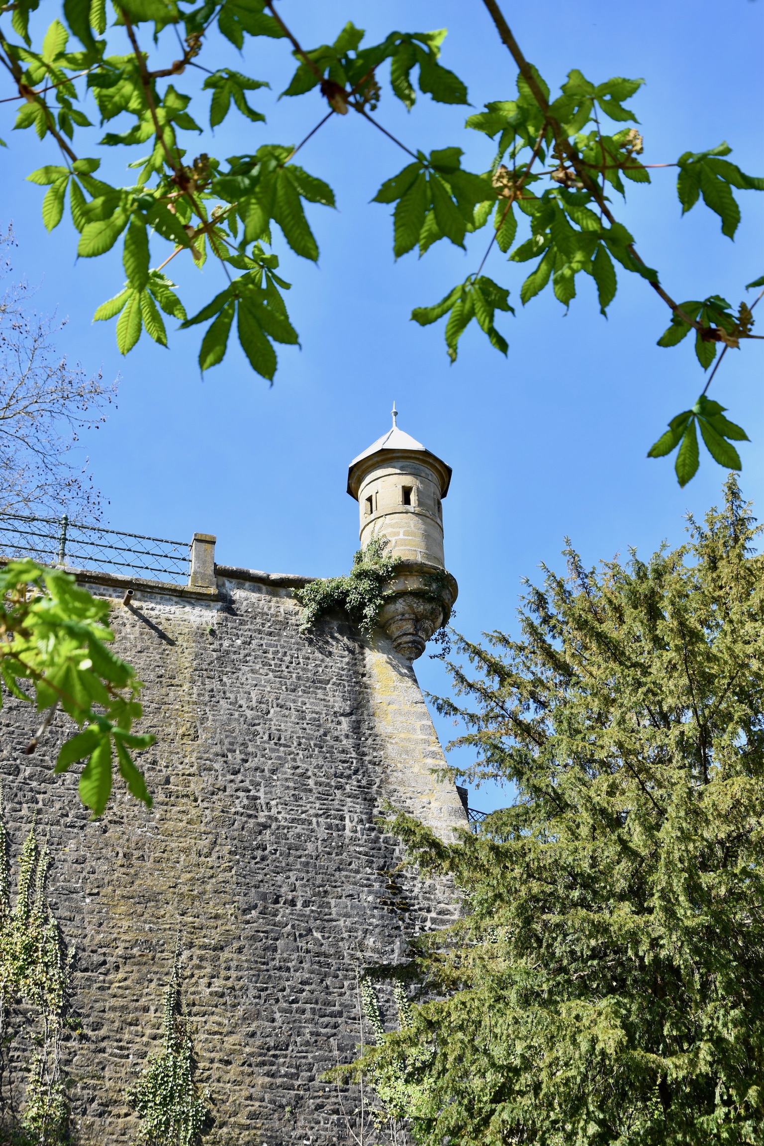
Built during Spanish rule in the 16th and 17th centuries, around 20 of these lookout towers still punctuate Luxembourg City’s cliffs and fortifications. Once forming a key part of the defensive ring guarding the fortress from attack, their purpose today is historical and touristic; photo-friendly reminders of Luxembourg’s military origins.
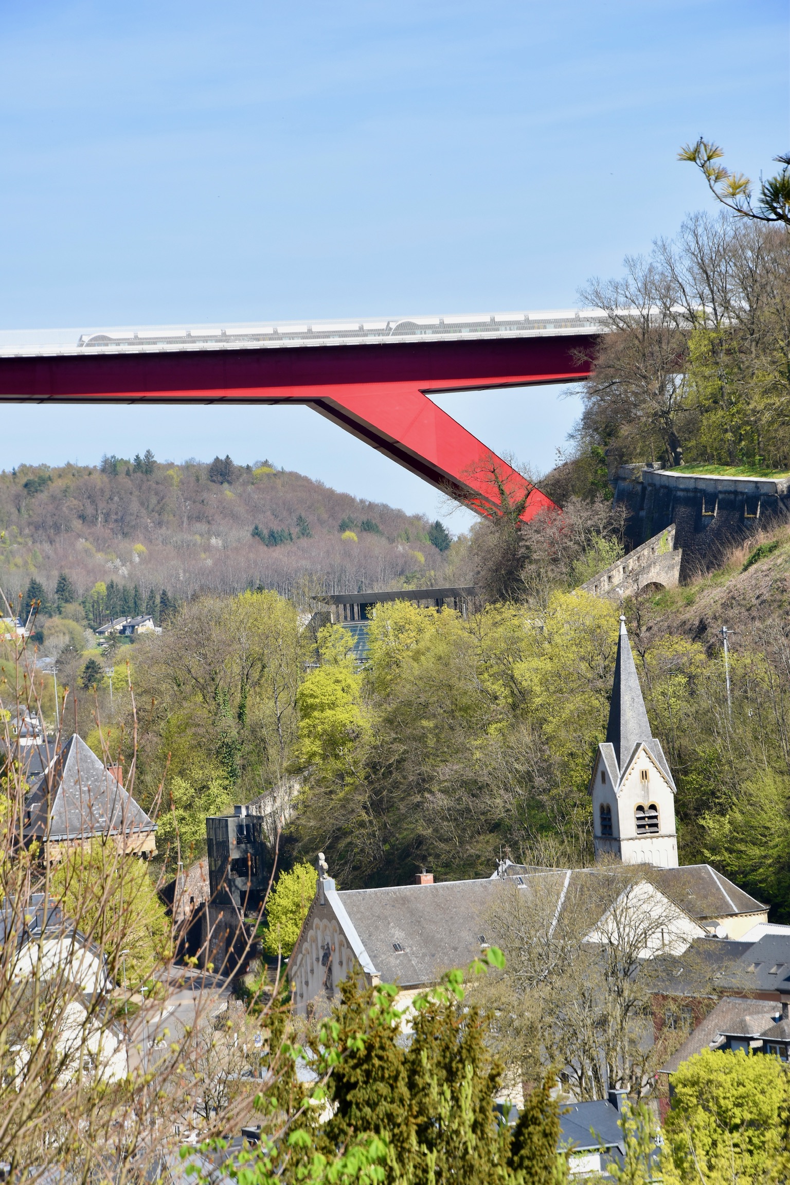
The trail continues down to the bottom of the Alzette valley, past the impressive Pfaffenthal lift and with the crimson span of the Pont Grande-Duchesse Charlotte looming in the background. Two more defensive structures – the Porte d’Eich and Porte des Bons Malades – soon come into view, one either side of the river with fortifications running between them. Part gateway, part defensive position, these structures once controlled movement along the river, ensuring that nothing could pass through this natural weak point in the city’s defences.
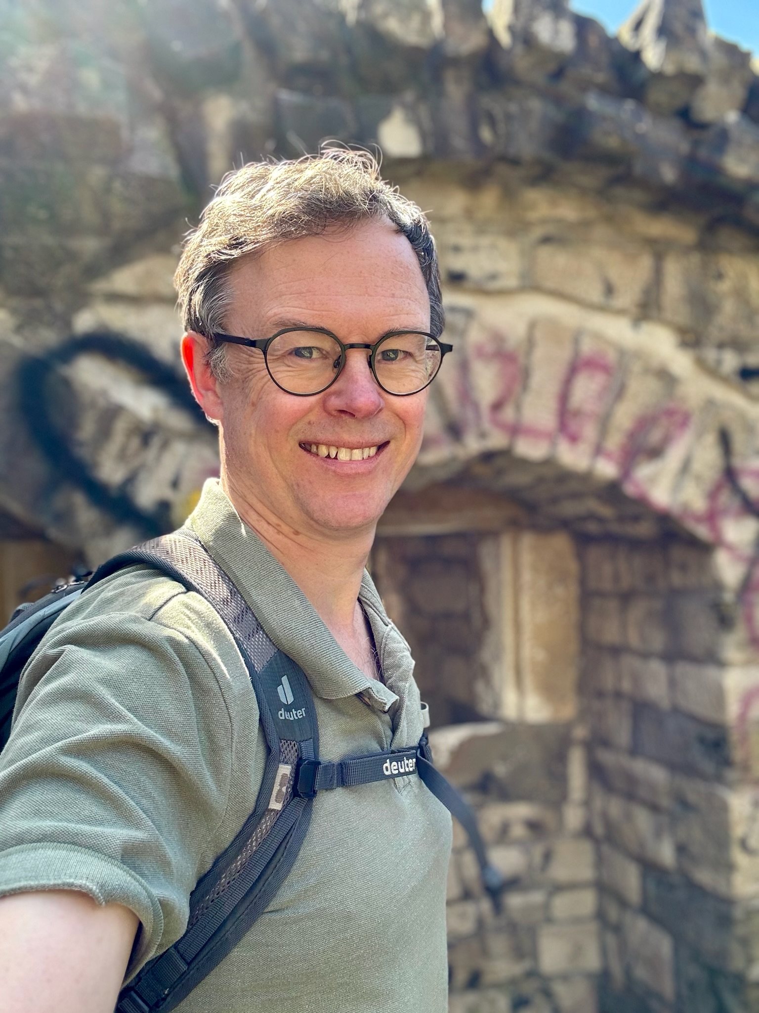
Nowadays, of course, it’s totally safe to cross the Alzette and start the most physically demanding section of the trail, the hike up via steps and increasingly rocky paths towards the Fort Niedergrünewald. This is perhaps my favourite location of the loop: its off-the-beaten-track location means that it hasn’t been as heavily restored as other parts of the old fortifications, and its graffiti-strewn edginess and run-down feel give it an atmospheric old-meets-modern vibe.
If you don’t feel comfortable at the Fort Niedergrünewald, you can move on quickly to, as the German speakers will have guessed, the Fort Obergrünewald through a heavily-forested area which will leave you questioning if you’re still in the centre of a European capital city.
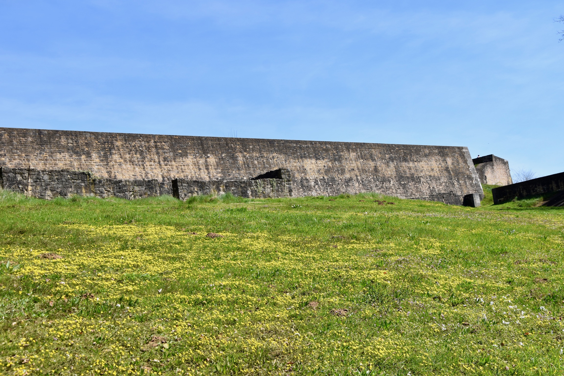
This part has been transformed today into the Park Dräi Eechelen, an utterly fascinating and much-loved area of Luxembourg City that invites you to take your time and explore. This is fortress architecture at its most imposing: thick stone, sharp angles and commanding views over the eastern approaches to the city.
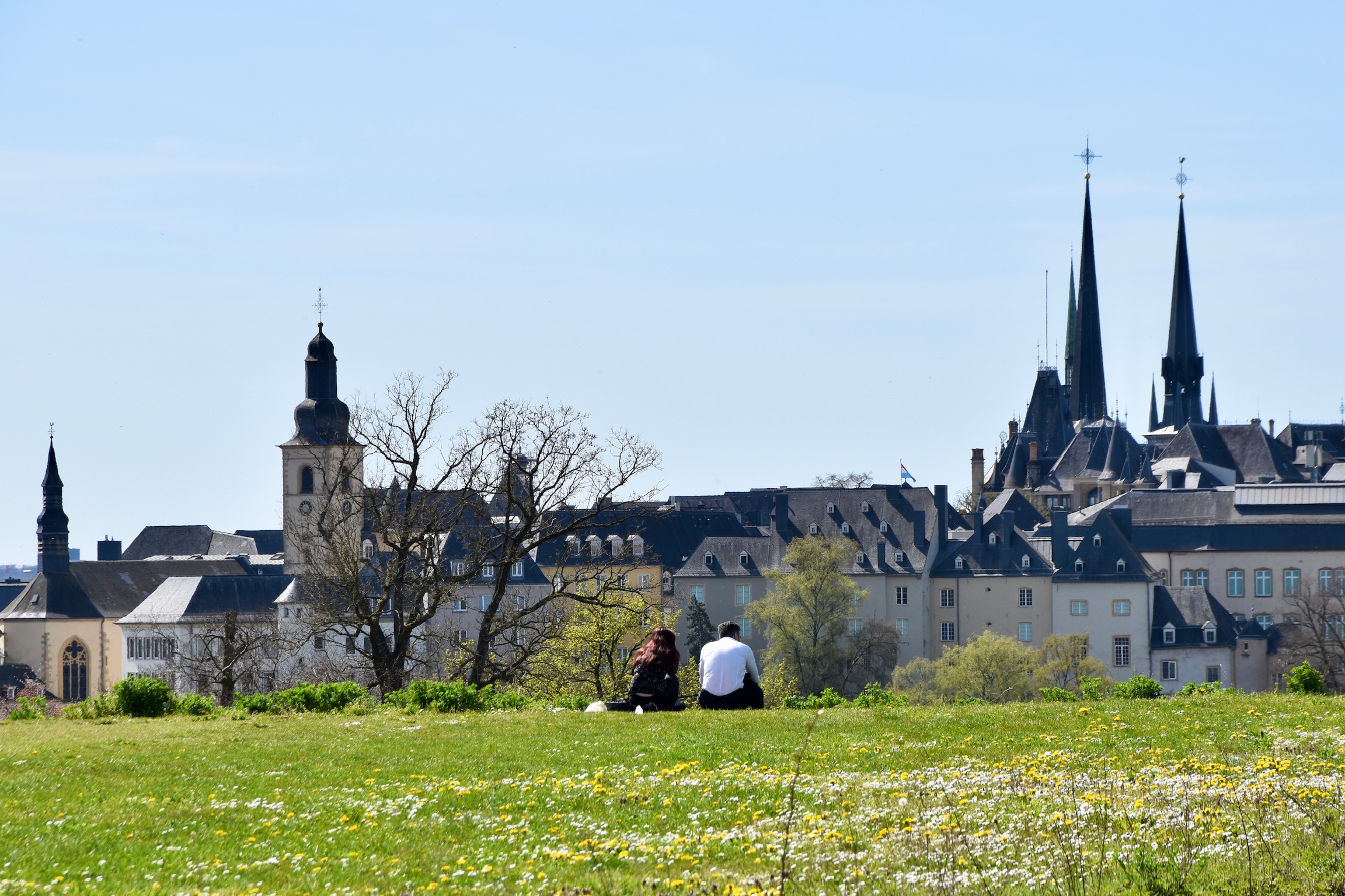
Whilst once this elevated position controlled access to Luxembourg’s heart, it today opens out into a spacious (and occasionally windswept) park where history sits alongside the vibrant life of Luxembourg citizens. Come up here at any time and there will be something happening: open-air dance classes, families picknicking, running groups congregating for pre- (or post-) run socialising. It’s a magical, unique spot worth lingering at.
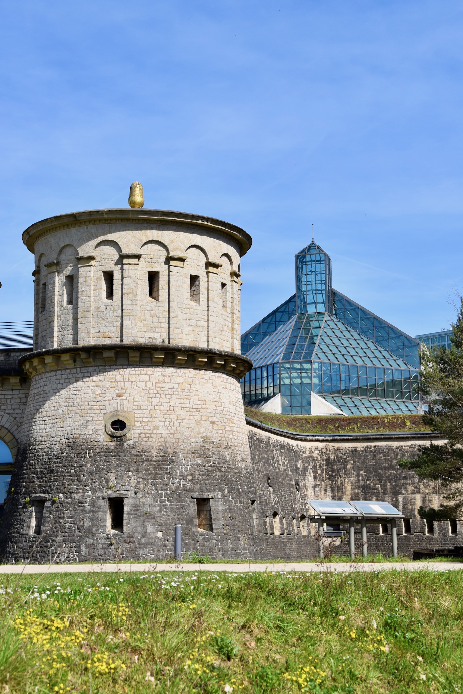
Having traversed the park, the trail does a 360° circumnavigation of two Luxembourg City Museums – the Musée Dräi Eechelen (brilliant further explanations of the city’s fortifications) and the MUDAM (Museum of Modern Art: the I. M. Pei-designed building is generally accepted as being more impressive than the exhibits…). Visiting one or both museums and exploring the chaos of fortifications in the park can easily turn this 5km hike into a worthy all-day exploration of Luxembourg City.
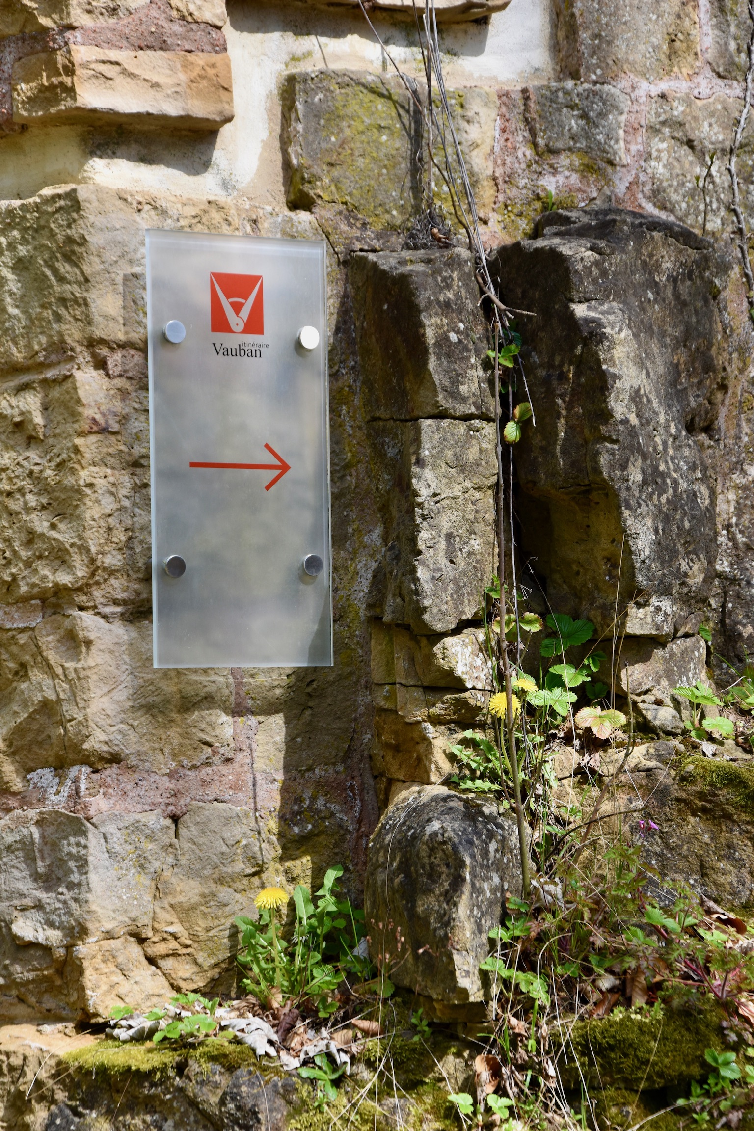
TIP: The official trail signs can be difficult to locate among the labyrinthine fortifications. Don’t stress out trying to find them. Simply explore the fort at your leisure, walk around the outside of the museums, then return through the fort to the edge of the valley and continue with your hike.
From the edge of the park, the trail descends once more back towards Clausen, zig-zagging down through birdsong-filled woods to join up with the Alzette river once again. Located in the shadow of a giant railway viaduct, the Luxembourg City Youth Hostel is a good spot for an inexpensive coffee or family-friendly lunch before the final push back up to the Bock.
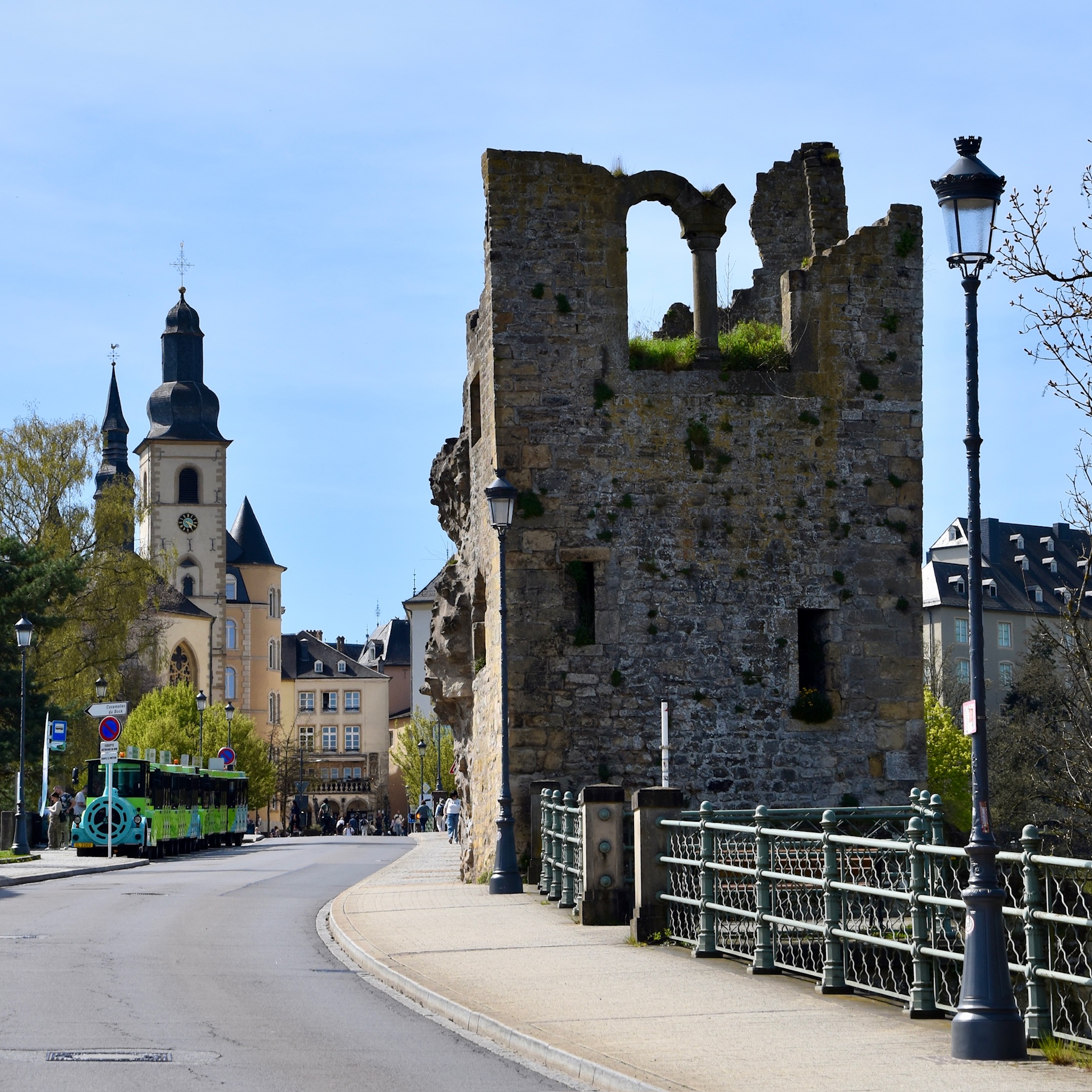
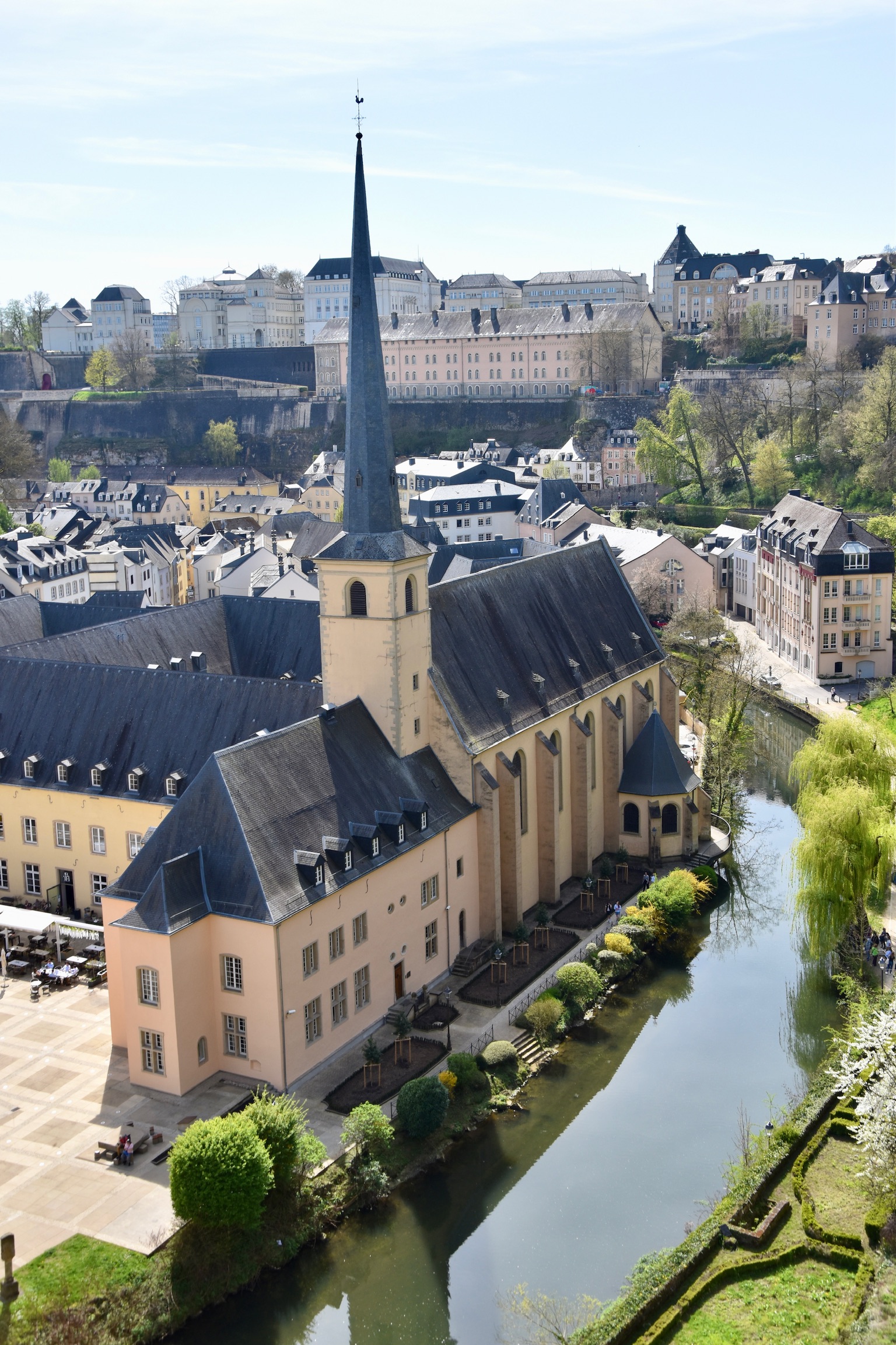
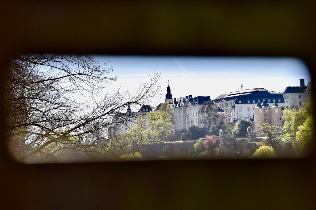
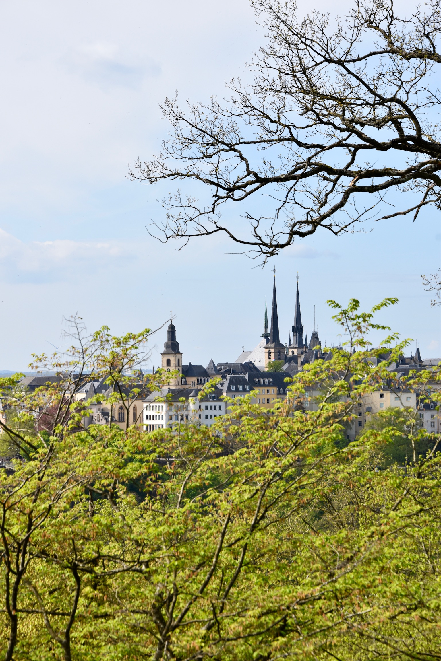
As you turn the final corner of the trail you’ll spot the Dent Creuse (“Hollow Tooth”, left above). I’ve often heard this wrongly described as “the oldest structure in Luxembourg”, but in reality it’s simply one of the oldest surviving parts of Fort Thüngen, a jagged remnant from 1732 that hints at an earlier version of the fortress. There’s nothing in particular to see there, so bear left instead to take in the majestic grande finale of the tour – the classic, superlative views over the Abbaye de Neumünster and the Grund (right). From this lofty vantage point, the green swathe of the Alzette frames the pastel-perfect abbey and anchors the old town rising behind, making for an unforgettable sight and an invitation to explore more of this fabulously hikeable city.
All text and photos (c) Jonathan Orr 2026

[…] change, my main April project was checking out three of Luxembourg City’s best walks: the Wenzel, Vauban and Mansfeld circular trails. All under 5km, all fabulous, and together they reminded me just how […]
LikeLike